Zell, Zurich
| Zell | ||
|---|---|---|
 |
||
|
||
| Coordinates: 47°27′N 8°49′E / 47.450°N 8.817°ECoordinates: 47°27′N 8°49′E / 47.450°N 8.817°E | ||
| Country | Switzerland | |
| Canton | Zürich | |
| District | Winterthur | |
| Area | ||
| • Total | 12.97 km2 (5.01 sq mi) | |
| Elevation | 541 m (1,775 ft) | |
| Population (Dec 2016) | ||
| • Total | 5,745 | |
| • Density | 440/km2 (1,100/sq mi) | |
| Postal code | 8487 | |
| SFOS number | 0231 | |
| Localities | Garten, Kollbrunn, Lettenberg, Rämismühle, Rikon, Schooren, Zell | |
| Surrounded by | Kyburg, Schlatt, Turbenthal, Weisslingen, Wildberg, Winterthur | |
| Website |
www SFSO statistics |
|
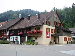
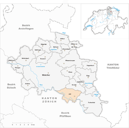
Zell is a municipality in the district of Winterthur in the canton of Zürich in Switzerland.
Zell has an area of 13 km2 (5.0 sq mi). Of this area, 43.1% is used for agricultural purposes, while 42.1% is forested. Of the rest of the land, 12.5% is settled (buildings or roads) and the remainder (2.3%) is non-productive (rivers, glaciers or mountains). In 1996[update] housing and buildings made up 9.1% of the total area, while transportation infrastructure made up the rest (3.8%). Of the total unproductive area, water (streams and lakes) made up 1.7% of the area. As of 2007[update], 12.2% of the total municipal area was undergoing some type of construction.
Zell is situated in the upper Töss Valley. In Zell-Rikon is a Tibetan monastery, the Tibet Institute Rikon. The municipality also includes the hamlet of Kollbrunn.
Zell has a population (as of 31 December 2016) of 5,745. As of 2007[update], 17.6% of the population was made up of foreign nationals. As of 2008[update] the gender distribution of the population was 50.3% male and 49.7% female. Over the last 10 years the population has grown at a rate of 14.5%. Most of the population (as of 2000[update]) speaks German (87.6%), with Italian being second most common ( 2.8%) and Albanian being third ( 1.8%).
...
Wikipedia


