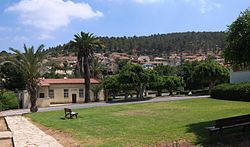
Zekharia
| Zekharia | |
|---|---|
 |
|
| Coordinates: 31°42′35.28″N 34°56′42.35″E / 31.7098000°N 34.9450972°ECoordinates: 31°42′35.28″N 34°56′42.35″E / 31.7098000°N 34.9450972°E | |
| District | Jerusalem |
| Council | Mateh Yehuda |
| Affiliation | Moshavim Movement |
| Founded | 1950 |
| Founded by | Kurdish Jews |
| Population (2015) | 1,039 |
Zekharia (Hebrew: זְכַרְיָה) is a moshav in central Israel. Located near Beit Shemesh, it falls under the jurisdiction of Mateh Yehuda Regional Council. In 2015 it had a population of 1,039.
The village lies next to the road between Bayt Jibrin and the Jerusalem-Jaffa highway, and has a mean elevation of 268 meters above sea level. It is bordered on its south-east by the Elah Valley, and is situated about 5 kilometres (3.1 mi) south-west of Beit Shemesh. The mountain of Azekah can be seen directly to the south of the village. The villagers obtained their drinking water from two communal wells:- al-Saflani well which was drilled next to Wadi 'Ajjur, and al-Sarara well located north of the village.
The town called Beth Zacharia is said to have existed in Roman times. According to legend, the body of the prophet Zachariah was found here in 415 CE and a church and monastery were established. The village was under the administrative jurisdiction of Bayt Jibrin. During the Mamluk era, the village was a dependency of Hebron, and formed part of the waqf supporting the Ibrahimi Mosque.
In the 1480s C.E. Felix Fabri described how he stayed in a "roomy inn", next to a "fair mosque" in the village.
In 1517, Az-Zakariyya was incorporated into the Ottoman Empire with the rest of Palestine, and in 1596 the village appeared in the Ottoman tax registers listed as Zakariyya al-Battikh under the administration of the nahiya ("subdistrict") of Quds (Jerusalem), part of the Sanjak of Quds. It had a population of 47 Muslim households and paid taxes on wheat, barley, olives, beehives, and goats.
...
Wikipedia

