Zama, Kanagawa
|
Zama 座間市 |
|||
|---|---|---|---|
| City | |||

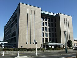
Zama City Hall
|
|||
|
|||
 Location of Zama in Kanagawa Prefecture |
|||
| Coordinates: 35°29′N 139°24′E / 35.483°N 139.400°ECoordinates: 35°29′N 139°24′E / 35.483°N 139.400°E | |||
| Country | Japan | ||
| Region | Kantō | ||
| Prefecture | Kanagawa Prefecture | ||
| Area | |||
| • Total | 17.58 km2 (6.79 sq mi) | ||
| Population (June 1, 2012) | |||
| • Total | 129,568 | ||
| • Density | 7,370/km2 (19,100/sq mi) | ||
| Time zone | Japan Standard Time (UTC+9) | ||
| Symbols | |||
| • Tree | Osmanthus | ||
| • Flower | Sunflower | ||
| • Bird | Japanese tit | ||
| Phone number | 046-255-1111 | ||
| Address | 1-1-1 Midorigaoka, Zama-shi, Kanagawa-ken 228-8566 | ||
| Website | www |
||
Zama (座間市 Zama-shi?) is a city located in central Kanagawa Prefecture, Japan. The city is also home to the United States' Camp Zama Army base.
As of June 1, 2012, the city has an estimated population of 129,568 and a population density of 7,370 persons per km2. The total area is 17.58 km2.
Located in central Kanagawa Prefecture, the city is mostly flat, although some parts are hilly. The Sagami River, Mekushiri River, and the Hato River flow through Zama. The city is well known for its drinking water, which is cold in the summer and warm in the winter.
The area around Zama has been settled since prehistoric times, and Jomon period remains have been found. The hamlet of "Izama" was a post station on the ancient Tōkaidō road connecting Kyoto with the provinces in the Kantō region, and the area was part of the tenryō territory within Sagami Province during the Edo period administered directly by the Tokugawa shogunate through a number of hatamoto-class administrators. During the cadastral reforms after the Meiji Restoration in 1889, the area of present-day Zama consisted of five villages in Kōza District, Kanagawa Prefecture.
...
Wikipedia


