Zabok
| Zabok | |
|---|---|
| Town | |

Zabok town center
|
|
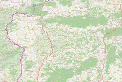
| Location of Zabok in Krapina-Zagorje County | |
| Coordinates: 46°02′N 15°55′E / 46.033°N 15.917°E | |
| Country |
|
| County |
|
| Elevation | 186 m (610 ft) |
| Population (2011) | |
| • Total | 8,994 (municipality) |
| Time zone | CET (UTC+1) |
| • Summer (DST) | CEST (UTC+2) |
Zabok is a town and municipality situated in northwest Croatia in the Krapina-Zagorje County. It has a total population of 8,994 (census 2011). Zabok is situated on the main crossroads in the heart of Hrvatsko zagorje region. Zabok is the economical centre of the Krapina-Zagorje County.
Zabok is located at 46°1′46″N 15°54′54″E / 46.02944°N 15.91500°E, at an altitude of 186 m above sea level. The following settlements comprise the city:
In the 2011 census, 98% of the population were Croats.
The biggest park area in Zabok is Milan Prpić's park. There are also other smaller parks in the centre of Zabok, along with a number of playgrounds which were built as part of the town's housing projects. Town's cemetery with a finely kept garden is located in the northeastern part of the town centre.
The town's major Ivan Hanžek (Social Democratic Party of Croatia) was elected a member of the Croatian Parliament in the 2007 parliamentary election.
"Zabok" means "behind the river curve" (the river in question is the Krapinica). The name Zabok first appeared in 1335 in a text in which ownership of Zabok was given to Petar, son of Nuzlin, by the King of Hungary, Karlo I. The Nuzlin family added the prefix de Zabok to their name and, by the 15th century, had started naming themselves "Zaboky de Zabok".
In 1782, Sigismund Vojković-Vojkffy started the construction of a church in Zabok, completing it in 1805. With the abolition of the feudalism, former serfs were offered a possibility of choosing their own place of settlement, and the majority settled along the roads connecting Gredice and Bračak with the new centre developing around the church, to form the new city centre. The town reached its final shape in the period after World War II, when it spread longitudinally along the northern side of the railway track.
...
Wikipedia


