Yellowstone Regional Airport
| Yellowstone Regional Airport | |||||||||||
|---|---|---|---|---|---|---|---|---|---|---|---|
| Summary | |||||||||||
| Airport type | Public | ||||||||||
| Owner | City of Cody | ||||||||||
| Serves | Cody, Wyoming | ||||||||||
| Elevation AMSL | 5,102 ft / 1,555 m | ||||||||||
| Coordinates | 44°31′13″N 109°01′26″W / 44.52028°N 109.02389°WCoordinates: 44°31′13″N 109°01′26″W / 44.52028°N 109.02389°W | ||||||||||
| Website | www |
||||||||||
| Map | |||||||||||
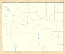
| Location of airport in Wyoming / United States | |||||||||||
| Runways | |||||||||||
|
|||||||||||
| Statistics (2015) | |||||||||||
|
|||||||||||
|
Source: Federal Aviation Administration
|
|||||||||||
| Aircraft operations | 55,688 |
|---|---|
| Based aircraft | 79 |
Yellowstone Regional Airport (IATA: COD, ICAO: KCOD, FAA LID: COD) is a public-use airport located two nautical miles (3.7 km) southeast of the central business district of Cody, a city in Park County, Wyoming, United States. It is the only commercial airport in Park County. It is in northwestern Wyoming, about 53 miles from the east entrance of Yellowstone National Park.
The airport is owned by the city of Cody and is operated by the Yellowstone Regional Airport Joint Powers Board. This board was established in 1981 and is made up of 7 members appointed the Cody City Council and the Park County Commission. The daily operations of the airport are overseen by an Airport Manager, who is appointed by the board.
It should not be confused with Yellowstone Airport, located 104 miles (167 km) away in West Yellowstone, Montana, near the west entrance to Yellowstone National Park.
Yellowstone Regional Airport covers an area of 694 acres (281 ha) at an elevation of 5,102 feet (1,555 m) above mean sea level. It has one runway designated 4/22 with an asphalt surface measuring 8,268 by 100 feet (2,520 x 30 m).
For the 12-month period ending December 31, 2008, the airport had 37,490 aircraft operations, an average of 102 per day: 83% general aviation, 17% air taxi, and <1% military. At that time there were 68 aircraft based at this airport: 82% single-engine, 6% multi-engine, 7% jet, 3% helicopter, and 2% glider.
...
Wikipedia


