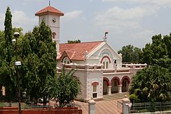
Yavatmal
|
Yavatmal यवतमाळ |
|
|---|---|
| City | |

Yavatmal Municipal Council
|
|
| Nickname(s): Cotton city | |
| Location in Maharashtra, India | |
| Coordinates: 20°14′N 78°04′E / 20.24°N 78.06°ECoordinates: 20°14′N 78°04′E / 20.24°N 78.06°E | |
| Country |
|
| State | Maharashtra |
| Region | Vidarbha |
| District | Yavatmal |
| Government | |
| • Type | Municipality |
| • Body | Yavatmal Municipal Council |
| Elevation | 445 m (1,460 ft) |
| Population (2011) | |
| • City | 116,551 |
| • Metro | 138,303 |
| Languages | |
| • Official | Marathi |
| Time zone | IST (UTC+5:30) |
| PIN | 445001 |
| Telephone code | 07232 |
| Vehicle registration | MH 29 |
| Website | www |
Yavatmal (![]() pronunciation is a city and municipal council in the Indian state of Maharashtra. It is the administrative headquarters of Yavatmal District. Yavatmal is around 150 kilometres (93 mi) away from regional headquarter Maharashtra while it is 670 km (420 mi) away from the state capital Mumbai. The name is derived from the Marathi Yavat (mountain) and mal (row).
pronunciation is a city and municipal council in the Indian state of Maharashtra. It is the administrative headquarters of Yavatmal District. Yavatmal is around 150 kilometres (93 mi) away from regional headquarter Maharashtra while it is 670 km (420 mi) away from the state capital Mumbai. The name is derived from the Marathi Yavat (mountain) and mal (row).
Formerly known as "Yeoti" or "Yeotmal", Yavatmal City was the main town of the Berar Sultanate and according to old writings "the safest place in the world". The then region of Yavatmal (now Yavatmal district), was part of the dominion of Aladdin Hassan Bahman Shah who founded the Bahmani Sultanate in 1347. In 1572, Murtaza Shah ruler of the Ahmadnagar Sultanate (current day Ahmadnagar District), annexed the Yavatmal district, then in 1596, Chand Bibi, warrior queen of Ahmadnagar, ceded the district of Yavatmal to the Mughal Empire, rulers of a large part of India. Following the death of the sixth Mughal Emperor Aurangzeb in 1707, Yavatmal was passed on to the Maratha Empire. When Raghoji I Bhonsle became ruler of the Nagpur kingdom in 1783, he included the Yavatmal district in his territory. After the British East India Company created Berar Province in 1853, Yavatmal became part of East Berar District in 1863 and later part of the South East Berar district, both districts of the Central Provinces and Berar. Yavatmal remained part of Madhya Pradesh until the 1956 reorganization of states when it was transferred to the Bombay State. With the creation of the Maharashtra state on 1 May 1960, Yavatmal district became a part of it.
...
Wikipedia

