Woudrichem
| Woudrichem | |||
|---|---|---|---|
| City and municipality | |||

Martin Church and houses in 2015
|
|||
|
|||
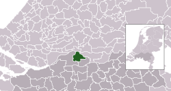
 Location in North Brabant |
|||
| Coordinates: 51°49′N 5°0′E / 51.817°N 5.000°ECoordinates: 51°49′N 5°0′E / 51.817°N 5.000°E | |||
| Country | Netherlands | ||
| Province | North Brabant | ||
| Government | |||
| • Body | Municipal council | ||
| • Mayor | Arie Noordergraaf (acting) (SGP) | ||
| Area | |||
| • Total | 51.70 km2 (19.96 sq mi) | ||
| • Land | 49.34 km2 (19.05 sq mi) | ||
| • Water | 2.36 km2 (0.91 sq mi) | ||
| Elevation | 0 m (0 ft) | ||
| Population (February 2017) | |||
| • Total | 14,410 | ||
| • Density | 292/km2 (760/sq mi) | ||
| Demonym(s) | Woudrichemmer | ||
| Time zone | CET (UTC+1) | ||
| • Summer (DST) | CEST (UTC+2) | ||
| Postcode | 4280–4288 | ||
| Area code | 0183 | ||
| Website | www |
||
Woudrichem (Dutch pronunciation: [ˈʋʌudriɣəm]; Brabantian: Woerkum) is a municipality and a city in the province of North Brabant in the Netherlands.
The city of Woudrichem was granted city rights in 1356.
The municipality is located at 51°49′N 5°0′E / 51.817°N 5.000°E in the north of North Brabant just south of the center of the Netherlands. It is part of the region of Land van Heusden en Altena.
The city of Woudrichem is the largest settlement in the municipality. It is situated on the southbank of where the rivers Waal and Afgedamde Maas join to form the Boven Merwede. The other population centres in the municipality are:
Historical port in Woudrichem
Historical port in Woudrichem
Street view in Woudrichem
Reformed church in Giessen
The municipal council of Woudrichem has 15 members. The mayor is Arie Noordergraaf of the Reformed Political Party (SGP).
...
Wikipedia

