Worland, Wyoming
| Worland, Wyoming | ||
|---|---|---|
| City | ||
|
||
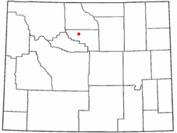
 Location in Washakie County and the state of Wyoming |
||
| Location in the United States | ||
| Coordinates: 44°0′55.39″N 107°57′23.87″W / 44.0153861°N 107.9566306°WCoordinates: 44°0′55.39″N 107°57′23.87″W / 44.0153861°N 107.9566306°W | ||
| Country | United States | |
| State | Wyoming | |
| County | Washakie | |
| Settled | 1900 | |
| Incorporated | 1906 | |
| Government | ||
| • Mayor | David Duffy | |
| Area | ||
| • Total | 4.64 sq mi (12.02 km2) | |
| • Land | 4.56 sq mi (11.81 km2) | |
| • Water | 0.08 sq mi (0.21 km2) 1.72% | |
| Elevation | 4,065 ft (1,239.01 m) | |
| Population (2010) | ||
| • Total | 5,487 | |
| • Estimate (2012) | 5,454 | |
| • Density | 1,203.3/sq mi (464.6/km2) | |
| Time zone | Mountain (UTC-7) | |
| • Summer (DST) | Mountain (UTC-6) | |
| ZIP code | 82401 | |
| Area code(s) | 307 | |
| FIPS code | 56-84925 | |
| GNIS feature ID | 1596624 | |
| Website | www.cityofworland.org | |
Worland is a city in Washakie County, Wyoming, United States. The population was 5,487 at the 2010 census. It is the county seat of Washakie County. It is located within the Big Horn Basin and along the Big Horn River in northwestern Wyoming
Worland is located at 44°00′55″N 107°57′24″W / 44.015387°N 107.956632°W (44.015387, −107.956632). It is located on the Big Horn River, in the Big Horn Basin.
According to the United States Census Bureau, the city has a total area of 4.64 square miles (12.02 km2), of which, 4.56 square miles (11.81 km2) is land and 0.08 square miles (0.21 km2) is water.
Worland experiences an arid climate (Köppen BWk) with long, cold, dry winters and hot, wetter summers. Worland falls into USDA Hardiness Zone 4b.
As of the census of 2010, there were 5,487 people, 2,310 households, and 1,479 families residing in the city. The population density was 1,203.3 inhabitants per square mile (464.6/km2). There were 2,473 housing units at an average density of 542.3 per square mile (209.4/km2). The racial makeup of the city was 89.9% White, 0.3% African American, 1.3% Native American, 0.6% Asian, 5.3% from other races, and 2.6% from two or more races. Hispanic or Latino of any race were 16.6% of the population.
...
Wikipedia

