Woodmere, Ohio
| Woodmere, Ohio | |
|---|---|
| Village | |

Houses on Brainard Road
|
|
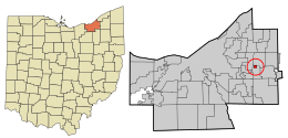
 Location in Cuyahoga County and the state of Ohio. |
|
| Coordinates: 41°27′33″N 81°28′52″W / 41.45917°N 81.48111°WCoordinates: 41°27′33″N 81°28′52″W / 41.45917°N 81.48111°W | |
| Country | United States |
| State | Ohio |
| County | Cuyahoga |
| Government | |
| • Type | Mayor-council |
| • Mayor | Chuck Smith |
| Area | |
| • Total | 0.33 sq mi (0.85 km2) |
| • Land | 0.33 sq mi (0.85 km2) |
| • Water | 0 sq mi (0 km2) |
| Elevation | 1,210 ft (0 m) |
| Population (2010) | |
| • Total | 884 |
| • Estimate (2012) | 874 |
| • Density | 2,678.8/sq mi (1,034.3/km2) |
| census | |
| Time zone | EST (UTC-4) |
| • Summer (DST) | EDT (UTC-4) |
| Zip code | 44122 |
| Area code(s) | 216 |
| FIPS code | |
| GNIS feature ID | |
| Website | http://www.woodmerevillage.com/ |
Woodmere is a village and eastern suburb of the Greater Cleveland area in the US state of Ohio. As of the 2010 census, Woodmere had a population of 884 residents. The village is bounded on the north by the city of Pepper Pike, on the west by the city of Beachwood, and on the south and east by the village of Orange.
Woodmere is one of the five municipalities, along with Hunting Valley, Moreland Hills, Orange Village and Pepper Pike, that originally formed Orange Township, the birthplace of President James A. Garfield. While the other four municipalities were established in the 1920s, Woodmere was incorporated as a village in 1944. Today, centered along Chagrin Boulevard, Woodmere serves as the primary commercial district for all parts of the original Orange Township.
Woodmere is located at 41°27′33″N 81°28′52″W / 41.45917°N 81.48111°W (41.459253, -81.481010).
According to the United States Census Bureau, the village has a total area of 0.33 square miles (0.85 km2), all land.
...
Wikipedia
