Woodmancote, Tewkesbury Borough
| Woodmancote | |
|---|---|
 Bishops Cleeve and Woodmancote from Cleeve Hill |
|
| Woodmancote shown within Gloucestershire | |
| Population | 3,029 (2011 Census) |
| OS grid reference | SO971272 |
| Civil parish |
|
| District | |
| Shire county | |
| Region | |
| Country | England |
| Sovereign state | United Kingdom |
| Post town | Cheltenham |
| Postcode district | GL52 |
| Dialling code | 01242 |
| Police | Gloucestershire |
| Fire | Gloucestershire |
| Ambulance | South Western |
| EU Parliament | South West England |
Woodmancote is a village and civil parish located in Gloucestershire, England. It lies adjacent to Bishop's Cleeve and Cleeve Hill, 4 miles north of Cheltenham. In old English the name meant ‘woodmen’s cottage’ and an early form was Wudumannacote.
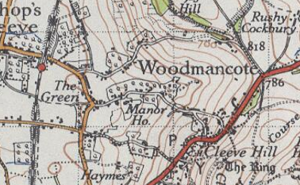
The maps above highlight the fact that no significant development occurred between 1828 and 1945, only infrastructure such as new roads and a railway line seem to be new features. The physical lack of development is also shown in its neighbouring town Bishop's Cleeve. It does show a large amount of arable land as fields in both pictures. This would suggest that the people who lived there were mostly working in agriculture for many generations.
The Doomsday book (1086) does not include Woodmancote. However it became a place in its own right when estates in the area were organised by the Bishop’s officers around the year of 1170. Over centuries Woodmancote remained an area of smallholdings and arable fields. Only until 1847 the traditional farming of the villagers on medieval open-fields ended as arable land became enclosed into the fields we see today. For 600 years Bishop's Cleeve and Woodmancote have been hard to define as two separate parishes. This was because both were "in the same manor of the Bishop of Worcester and so it is often impossible to distinguish in his records". The Black Death saw one third of the population of Bishop's Cleeve and Woodmancote die.
...
Wikipedia


