Woodland Park, Colorado
| City of Woodland Park, Colorado | |
|---|---|
| City | |

A section of historic downtown Woodland Park.
|
|
| Nickname(s): The city above the clouds | |
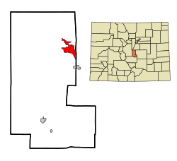
 Location in Teller County and the state of Colorado |
|
| Coordinates: 38°59′54″N 105°3′23″W / 38.99833°N 105.05639°WCoordinates: 38°59′54″N 105°3′23″W / 38.99833°N 105.05639°W | |
| Country |
|
| State |
|
| County | Teller County |
| Incorporated | June 6, 1891 |
| Government | |
| • Type | Home Rule Municipality |
| • Mayor | Neil Levy |
| Area | |
| • Total | 5.7 sq mi (14.7 km2) |
| • Land | 5.7 sq mi (14.7 km2) |
| • Water | 0 sq mi (0 km2) |
| Elevation | 8,465 ft (2,580 m) |
| Population (2000) | |
| • Total | 6,515 |
| • Density | 1,143/sq mi (443.2/km2) |
| Time zone | MST (UTC-7) |
| • Summer (DST) | MDT (UTC-6) |
| ZIP code | 80863, 80866 (PO Box) |
| Area code(s) | 719 |
| FIPS code | 08-86090 |
| GNIS feature ID | 0204768 |
| Website | www.citywoodlandpark.org |
The City of Woodland Park is a Home Rule Municipality that is the most populous city in Teller County, Colorado, United States and is immediately west of El Paso County and the unincorporated community of Crystola. Many residents in this bedroom community, which is surrounded by the one-million acre (4,000 km²) Pike National Forest, make the 17-mile (27 km) commute to Colorado Springs. Ute Pass lies 12 miles (19 km) to the west of Woodland Park on US 24. The population was 6,515 at the 2000 census. Nearby Douglas County is about a fifteen-minute drive from the city.
A post office called Woodland Park has been in operation since 1890. The community was named for the abundance of trees near the original town site.
Woodland Park is located at the eastern intersection of U.S. Highway 24 and State Highway 67. (The highways overlap west to Divide.)
According to the United States Census Bureau, the city has a total area of 5.7 square miles (15 km2), all of it land.
As of the census of 2000, there were 6,515 people, 2,476 households, and 1,884 families residing in the city. The population density was 1,151.0 people per square mile (444.4/km²). There were 2,642 housing units at an average density of 466.8 per square mile (180.2/km²). The racial makeup of the city was 94.89% White, 0.52% African American, 0.72% Native American, 0.87% Asian, 0.81% from other races, and 2.18% from two or more races. Hispanic or Latino of any race were 3.45% of the population.
...
Wikipedia
