Woodbury Township, Blair County, Pennsylvania
| Woodbury Township, Blair County, Pennsylvania |
|
|---|---|
| Township | |

The Daniel Royer House, a historic site in the township
|
|
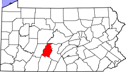
 Map of Blair County, Pennsylvania highlighting Woobury Township |
|
 Map of Blair County, Pennsylvania |
|
| Country | United States |
| State | Pennsylvania |
| County | Blair |
| Settled | 1765 |
| Incorporated | 1787 |
| Government | |
| • Type | Board of Supervisors |
| Area | |
| • Total | 32.4 sq mi (83.9 km2) |
| • Land | 32.4 sq mi (83.9 km2) |
| • Water | 0.0 sq mi (0.0 km2) |
| Population (2010) | |
| • Total | 1,693 |
| • Density | 52/sq mi (20.2/km2) |
| Time zone | Eastern (EST) (UTC-5) |
| • Summer (DST) | EDT (UTC-4) |
| Area code(s) | 814 |
Woodbury Township is a township in Blair County, Pennsylvania, United States. It is part of the Altoona, PA Metropolitan Statistical Area. The population was 1,693 at the 2010 census.
Woodbury Township is located along the eastern edge of Blair County, with Huntingdon County to the east. It is bordered by the Frankstown Branch of the Juniata River and the borough of Williamsburg to the north, by the ridgecrest of Tussey Mountain to the east, and by the crest of Lock Mountain to the west.
According to the United States Census Bureau, the township has a total area of 32.4 square miles (83.9 km2), all of it land.
As of the census of 2000, there were 1,637 people, 570 households, and 458 families residing in the township. The population density was 50.3 people per square mile (19.4/km²). There were 614 housing units at an average density of 18.9/sq mi (7.3/km²). The racial makeup of the township was 97.86% White, 1.41% African American, 0.06% Native American, 0.06% Asian, 0.06% from other races, and 0.55% from two or more races. Hispanic or Latino of any race were 0.31% of the population.
...
Wikipedia
