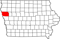
Woodbury County, Iowa
| Woodbury County, Iowa | |
|---|---|

Woodbury County Courthouse in Sioux City
|
|
 Location in the U.S. state of Iowa |
|
 Iowa's location in the U.S. |
|
| Founded | 1851 |
| Named for | Levi Woodbury |
| Seat | Sioux City |
| Largest city | Sioux City |
| Area | |
| • Total | 878 sq mi (2,274 km2) |
| • Land | 872.59 sq mi (2,260 km2) |
| • Water | 4.79 sq mi (12 km2), 0.55% |
| Population | |
| • (2010) | 102,172 |
| • Density | 117/sq mi (45/km²) |
| Congressional district | 4th |
| Time zone | Central: UTC-6/-5 |
| Website | www |
Woodbury County is a county located in the U.S. state of Iowa. As of the 2010 census, the population was 102,172. The county seat is Sioux City.
Woodbury County is included in the Sioux City, IA-NE-SD Metropolitan Statistical Area.
Originally established in 1851 as Wahkaw County, the Iowa Legislature in 1853 changed the name to Woodbury County in honor of Levi Woodbury (1789–1851), a senator and Governor of New Hampshire who served as a Supreme Court justice from 1844 until his death.
The first county seat of Wahkaw County was the now-extinct village of Thompsonville; when the Legislature changed the county name to Woodbury, the new county seat became Sergeant's Bluff (now Sergeant Bluff). The county seat was moved to Sioux City in 1856.
The Winnebago Tribe of Nebraska (Ho-Chunk) also owns reservation land in Woodbury County.
According to the U.S. Census Bureau, the county has a total area of 878 square miles (2,270 km2), of which 873 square miles (2,260 km2) is land and 4.9 square miles (13 km2) (0.6%) is water. It is the third-largest county by area in Iowa.
The 2010 census recorded a population of 102,172 in the county, with a population density of 117.062/sq mi (45.1980/km2). There were 41,454 housing units, of which 39,052 were occupied.
As of the census of 2000, there were 103,877 people, 39,151 households, and 26,426 families residing in the county. The population density was 119 people per square mile (46/km²). There were 41,394 housing units at an average density of 47 per square mile (18/km²). The racial makeup of the county was 87.48% White, 2.02% Black or African American, 1.69% Native American, 2.41% Asian, 0.04% Pacific Islander, 4.37% from other races, and 1.99% from two or more races. 9.11% of the population were Hispanic or Latino of any race.
...
Wikipedia
