Womrath
| Womrath | ||
|---|---|---|

Catholic chapel
|
||
|
||
| Coordinates: 49°55′03″N 7°26′55″E / 49.91750°N 7.44861°ECoordinates: 49°55′03″N 7°26′55″E / 49.91750°N 7.44861°E | ||
| Country | Germany | |
| State | Rhineland-Palatinate | |
| District | Rhein-Hunsrück-Kreis | |
| Municipal assoc. | Kirchberg | |
| Government | ||
| • Mayor | Dieter Herber | |
| Area | ||
| • Total | 8.39 km2 (3.24 sq mi) | |
| Elevation | 375 m (1,230 ft) | |
| Population (2015-12-31) | ||
| • Total | 193 | |
| • Density | 23/km2 (60/sq mi) | |
| Time zone | CET/CEST (UTC+1/+2) | |
| Postal codes | 55481 | |
| Dialling codes | 06763 | |
| Vehicle registration | SIM | |
| Website | www |
|
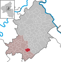
Womrath is an Ortsgemeinde – a municipality belonging to a Verbandsgemeinde, a kind of collective municipality – in the Rhein-Hunsrück-Kreis (district) in Rhineland-Palatinate, Germany. It belongs to the Verbandsgemeinde of Kirchberg, whose seat is in the like-named town.
The municipality lies on a ridge in the Hunsrück, roughly 4 km southeast of Kirchberg and 12 km east of Frankfurt-Hahn Airport. Also belonging to the village is an outlying hamlet called Wallenbrück, in the Simmerbach valley.
Womrath has been settled since the Stone Age, as witnessed by archaeological finds made within municipal limits. From the times of the Celts, the Treveri (a people of mixed Celtic and Germanic stock, from whom the Latin name for the city of Trier, Augusta Treverorum, is also derived) and the Romans have come parts of a statue of Jupiter, jewellery, clay pots, clay and copper urns.
The Romans built a road through Womrath linking the Trier–Bingen long-distance road at Dumnissus (now Denzen, an Ortsteil of Kirchberg) with the Nahe valley and going farther on to Cruciniacum (now Bad Kreuznach). In 1924, evidence was found only 50 cm deep in the ground of a paved Roman road.
...
Wikipedia


