Wollongong
|
Wollongong New South Wales |
|||||||
|---|---|---|---|---|---|---|---|

Overlooking Wollongong at night
|
|||||||
| Coordinates | 34°25′59″S 150°52′59″E / 34.43306°S 150.88306°ECoordinates: 34°25′59″S 150°52′59″E / 34.43306°S 150.88306°E | ||||||
| Population | 292,388 (2015) (10th) | ||||||
| • Density | 510.99/km2 (1,323.46/sq mi) | ||||||
| Postcode(s) | 2500 | ||||||
| Elevation | 5 m (16 ft) | ||||||
| Area | 572.2 km2 (220.9 sq mi) | ||||||
| Time zone | AEST (UTC+10) | ||||||
| • Summer (DST) | AEDT (UTC+11) | ||||||
| Location | 84 km (52 mi) S of Sydney | ||||||
| LGA(s) | |||||||
| Region | Illawarra | ||||||
| Federal Division(s) | |||||||
|
|||||||
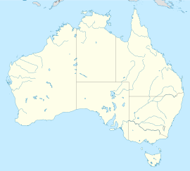
Wollongong (/ˈwʊləŋɡɒŋ/ WUUL-ləng-gong), informally referred to as "The Gong", is a seaside city located in the Illawarra region of New South Wales, Australia. Wollongong lies on the narrow coastal strip between the Illawarra Escarpment and the Pacific Ocean, 82 kilometres (51 miles) south of Sydney. Wollongong had an estimated urban population of 292,388 at June 2015, making it the third largest city in New South Wales after Sydney and Newcastle, and the tenth largest city in Australia.
The Wollongong metropolitan area extends from Helensburgh in the north to Shell Cove in the south. It sits within the Wollongong Statistical District, which covers the local authority areas of Wollongong, Shellharbour and Kiama, extending from the town of Helensburgh in the north to Gerroa in the south Geologically, the city is located in the south-eastern part of the Sydney basin, which extends from Newcastle to Nowra.
...
Wikipedia

