Winton, Queensland
|
Winton Queensland |
|||||||||||||
|---|---|---|---|---|---|---|---|---|---|---|---|---|---|

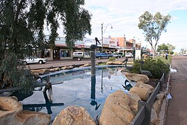
Main street of Winton
|
|||||||||||||
| Coordinates | 22°23′29″S 143°02′17″E / 22.3913°S 143.0381°ECoordinates: 22°23′29″S 143°02′17″E / 22.3913°S 143.0381°E | ||||||||||||
| Population | 954 (2011 census) | ||||||||||||
| Postcode(s) | 4735 | ||||||||||||
| Location |
|
||||||||||||
| LGA(s) | Winton Shire | ||||||||||||
| State electorate(s) | Mount Isa | ||||||||||||
| Federal Division(s) | Maranoa | ||||||||||||
|
|||||||||||||
|
|||||||||||||
|
|
Winton is a town and locality in the Shire of Winton in Central West Queensland, Australia. It is 177 kilometres (110 mi) northwest of Longreach. The main industries of the area are sheep and cattle raising. The town was named in 1876 by postmaster Robert Allen, after his place of birth, Winton, Dorset. At the 2011 census, Winton had a population of 954. Winton was the first home of the airline Qantas.
Winton lies on the north bank of the Western River, a braided river that often runs dry, made of many small channels, a landform that gives this region, the Channel Country, its name. The Western is joined from the north by Jessamine Creek and Mill's Creek, both braided streams, upstream to the east, just outside town, and across the river from town, Mistake Creek, likewise a braided stream, empties into the Western from the south. The Western itself flows westwards, eventually emptying into the Diamantina River at one of only three major confluences on that river. This lies some 60 km downstream. This puts Winton in the Lake Eyre basin. The land in the area is mostly flat grassland, which lends itself rather well to pastoral activity, an industry of some local importance to this day. Winton lies at the junction of the Kennedy Developmental Road and the Landsborough Highway, the two of which run concurrently from Winton's south end as far as another junction a few kilometres west of town.
The Diamantina River's hook-shaped upper reaches have drawn scientific attention. In March 2015, Geoscience Australia reported that the river's course at and near its headwaters flows along the edge of a roughly circular crustal anomaly that might well be an impact structure. It is an area, as described by Richard Blewett, a senior official with Geoscience Australia, 130 km in diameter, characterized by geomagnetic anomalies, and Winton lies roughly 60 km beyond its eastern edge. The Sydney Morning Herald reported that recent seismic studies undertaken there indicated that long ago an asteroid or comet struck the area releasing energy equivalent to 650 million Hiroshima A-bombs (and thus roughly 41 zettajoules). The asteroid impact has not yet been confirmed, but this could be done with core samples from the ground in the central ring structure to a depth of hundreds of metres. The impact, if indeed this is the explanation for the anomaly, would have happened roughly 300 million years ago.
...
Wikipedia

