Winter Star Mountain
| Black Mountains | |
|---|---|

The Black Mountains immersed in a snowstorm
|
|
| Highest point | |
| Peak | Mount Mitchell |
| Elevation | 6,699 ft (2,042 m) |
| Coordinates | 35°45′53″N 82°15′55″W / 35.76472°N 82.26528°WCoordinates: 35°45′53″N 82°15′55″W / 35.76472°N 82.26528°W |
| Geography | |
| Country | United States |
| State | North Carolina |
| Parent range | Blue Ridge Mountains |
| Geology | |
| Orogeny | Alleghenian |
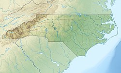
The Black Mountains are a mountain range in western North Carolina, in the southeastern United States. They are part of the Blue Ridge Province of the Southern Appalachian Mountains. The Blacks are the highest mountains in the Eastern United States. The range takes its name from the dark appearance of the red spruce and Fraser fir trees that form a spruce-fir forest on the upper slopes which contrasts with the brown (during winter) or lighter green (during the growing season) appearance of the deciduous trees at lower elevations. The Eastern Continental Divide, which runs along the eastern Blue Ridge crest, intersects the southern tip of the Black Mountain range.
The Black Mountains are home to Mount Mitchell State Park, which protects the range's highest summit and adjacent summits in the north-central section of the range. Much of the range is also protected by the Pisgah National Forest. The Blue Ridge Parkway passes along the range's southern section, and is connected to the summit of Mount Mitchell by North Carolina Highway 128. The Black Mountains are mostly located in Yancey County, although the range's southern and western extremes are part of Buncombe County.
The Black Mountains form a J-shaped semicircle that opens to the northwest. The Blacks rise southward from the Little Crabtree Creek Valley in the north to the steep 6,327-foot (1,928 m) summit of Celo Knob. A few miles south of Celo, the crest drops to 5,700 feet (1,700 m) at Deep Gap before rising steeply again to the summit of Potato Hill in the north-central section of the range. The crest continues southward across the north-central section, which contains 6 of the 10 highest summits in the eastern United States, including the highest, Mount Mitchell, and the second-highest, Mount Craig. South of Mount Mitchell, the crest drops to just under 6,000 feet (1,800 m) at Stepp's Gap before rising again to 6,520 feet (1,990 m) at the summit of Mount Gibbes. On the slopes of Potato Knob, just south of Clingmans Peak, the Black Mountain crest bends northwestward across Blackstock Knob before dropping again to 5,320 feet (1,620 m) at Balsam Gap, where it intersects the Great Craggy Mountains to the southwest. The crest then turns northward across Point Misery and Big Butt before descending to the Cane River Valley.
...
Wikipedia

