Winter Haven, Florida
| Winter Haven | ||
|---|---|---|
| City | ||

Central Avenue at the west side of downtown (Central Park is behind the photographer)
|
||
|
||
| Nickname(s): "The Chain of Lakes City" | ||
 |
||
| Coordinates: 28°2′N 81°43′W / 28.033°N 81.717°WCoordinates: 28°2′N 81°43′W / 28.033°N 81.717°W | ||
| Country | United States | |
| State | Florida | |
| County | Polk | |
| Incorporated | November 27, 1923 | |
| Area | ||
| • Total | 25.4 sq mi (65.8 km2) | |
| • Land | 17.7 sq mi (45.8 km2) | |
| • Water | 7.7 sq mi (20 km2) | |
| Elevation | 167 ft (51 m) | |
| Population (2010) | ||
| • Total | 33,874 | |
| • Estimate (2013) | 35,531 | |
| • Density | 1,042.8/sq mi (402.5/km2) | |
| Time zone | Eastern (EST) (UTC-5) | |
| • Summer (DST) | EDT (UTC-4) | |
| Area code(s) | 863 | |
| FIPS code | 12-78275 | |
| GNIS feature ID | 0293425 | |
| Website | City of Winter Haven | |
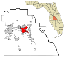
Winter Haven is a city in Polk County, Florida, United States. The population was 33,874 at the 2010 census. According to the U.S. Census Bureau's 2015 estimates, the city had a population of 37,689, making it the second most populated city in Polk County. It is a principal city of the Lakeland-Winter Haven, Florida Metropolitan Statistical Area.
The Timucua and the Calusa were the earliest known inhabitants of the land that would become Winter Haven. Both of these groups were deeply impacted, by war and disease, from the Spanish conquest of Florida in the early 1500s. The Timucua were particularly affected by the expedition of Hernando de Soto. By the 19th century, both these groups no longer existed. During these expeditions, the Spanish explorers claimed the entire peninsula of Florida for the Spanish monarchy
In the 19th century, the Creek and the Seminole were known to live and hunt in this area. During the Seminole Wars, the Seminole leader, Chipco, and his followers were known to live in the Winter Haven area. Several small skirmishes during the war were fought in and around Winter Haven.
In 1819, after the signing of the Adams-Onís Treaty, the United States gained control of Florida. The first American or European settlers in the area were encouraged to settle here by the Armed Occupation Act of 1842. This act was specifically created to increase the white population in the area as a way to weaken the Native Americans populations after the Second Seminole War. It created generous land grants and other incentives for settlers who were willing to defend themselves against the native populations, hence the name of the act.
During the 1840s and 1850s, the United States government conducted the first surveys of the area. Henry Washington conducted the first survey of the area in 1843. In 1849, Dr. John Westcott completed an extensive survey of the area, including mapping many of the local lakes. The first maps of the area were published by the United States government in 1854. In 1883, Col. Henry Haines working for Henry Plant and the Plant System, successfully built the first railroad across Polk County, passing just north of Winter Haven. Lake Haines, in Winter Haven, was named after Col. Haines.
...
Wikipedia

