Winnsboro Mills, South Carolina
| Winnsboro Mills, South Carolina | |
|---|---|
| Census-designated place | |
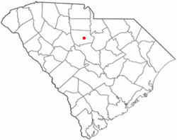
 Location of Winnsboro Mills, South Carolina |
|
| Coordinates: 34°21′24″N 81°4′58″W / 34.35667°N 81.08278°WCoordinates: 34°21′24″N 81°4′58″W / 34.35667°N 81.08278°W | |
| Country | United States |
| State | South Carolina |
| County | Fairfield |
| Area | |
| • Total | 2.6 sq mi (6.8 km2) |
| • Land | 2.6 sq mi (6.8 km2) |
| • Water | 0.0 sq mi (0.0 km2) |
| Elevation | 561 ft (171 m) |
| Population (2010) | |
| • Total | 1,898 |
| • Density | 721/sq mi (278.2/km2) |
| Time zone | Eastern (EST) (UTC-5) |
| • Summer (DST) | EDT (UTC-4) |
| ZIP code | 29180 |
| Area code(s) | 803 |
| FIPS code | 45-78505 |
| GNIS feature ID | 1231932 |
Winnsboro Mills is an unincorporated community and census-designated place (CDP) in Fairfield County, South Carolina, United States. The population was 1,898 at the 2010 census, down from 2,263 at the 2000 census. It is part of the Columbia, South Carolina Metropolitan Statistical Area.
Winnsboro Mills is located southeast of the center of Fairfield County at 34°21′24″N 81°4′58″W / 34.35667°N 81.08278°W (34.356734, -81.082834). It is bordered to the north by the town of Winnsboro, the county seat. U.S. Route 321 Business (Columbia Road) is the main road through the community.
According to the United States Census Bureau, the CDP has a total area of 2.6 square miles (6.8 km2), all of it land.
As of the census of 2000, there were 2,263 people, 885 households, and 593 families residing in the CDP. The population density was 819.9 people per square mile (316.6/km²). There were 1,005 housing units at an average density of 364.1/sq mi (140.6/km²). The racial makeup of the CDP was 54.75% White, 41.32% African American, 0.40% Native American, 0.53% Asian, 1.86% from other races, and 1.15% from two or more races. Hispanic or Latino of any race were 3.31% of the population.
...
Wikipedia
