Winifred, Montana
| Winifred, Montana | |
|---|---|
| Town | |

Downtown and Northeast Winifred (June 2015)
|
|
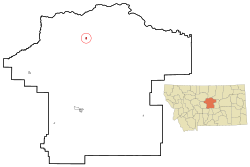
 Location of Winifred, Montana |
|
| Coordinates: 47°33′35″N 109°22′38″W / 47.55972°N 109.37722°WCoordinates: 47°33′35″N 109°22′38″W / 47.55972°N 109.37722°W | |
| Country | United States |
| State | Montana |
| County | Fergus |
| Area | |
| • Total | 0.50 sq mi (1.29 km2) |
| • Land | 0.50 sq mi (1.29 km2) |
| • Water | 0 sq mi (0 km2) |
| Elevation | 3,235 ft (986 m) |
| Population (2010) | |
| • Total | 208 |
| • Estimate (2012) | 207 |
| • Density | 416.0/sq mi (160.6/km2) |
| Time zone | Mountain (MST) (UTC-7) |
| • Summer (DST) | MDT (UTC-6) |
| ZIP code | 59489 |
| Area code(s) | 406 |
| FIPS code | 30-81025 |
| GNIS feature ID | 0778598 |
Winifred is a town in north-central Fergus County, Montana, United States. The population was 208 at the 2010 census. Winifred was founded in 1913 as the terminus of a newly built branch line of the Chicago, Milwaukee, St. Paul and Pacific Railroad ("the Milwaukee Road"). It is popularly believed to have been named after one of the railroad owner's two daughters (the other being Christina, another small town about 15 miles away).
Winifred is located at 47°33′35″N 109°22′38″W / 47.55972°N 109.37722°W (47.559818, -109.377108).
According to the United States Census Bureau, the town has a total area of 0.50 square miles (1.29 km2), all of it land.
According to the Köppen Climate Classification system, Winifred has a semi-arid climate, abbreviated "BSk" on climate maps.
As of the census of 2010, there were 208 people, 92 households, and 65 families residing in the town. The population density was 416.0 inhabitants per square mile (160.6/km2). There were 116 housing units at an average density of 232.0 per square mile (89.6/km2). The racial makeup of the town was 94.7% White, 1.0% African American, 3.4% Native American, 0.5% from other races, and 0.5% from two or more races. Hispanic or Latino of any race were 1.0% of the population.
...
Wikipedia
