Williams, Minnesota
| Williams, Minnesota | |
|---|---|
| City | |
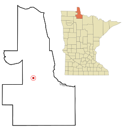
 Location of Williams, Minnesota |
|
| Coordinates: 48°46′7″N 94°57′16″W / 48.76861°N 94.95444°W | |
| Country | United States |
| State | Minnesota |
| County | Lake of the Woods |
| Area | |
| • Total | 0.97 sq mi (2.51 km2) |
| • Land | 0.97 sq mi (2.51 km2) |
| • Water | 0 sq mi (0 km2) |
| Elevation | 1,152 ft (351 m) |
| Population (2010) | |
| • Total | 191 |
| • Estimate (2016) | 180 |
| • Density | 200/sq mi (76/km2) |
| Time zone | Central (CST) (UTC-6) |
| • Summer (DST) | CDT (UTC-5) |
| ZIP code | 56686 |
| Area code(s) | 218 |
| FIPS code | 27-70402 |
| GNIS feature ID | 0654165 |
Williams is a city in Lake of the Woods County, Minnesota, United States. The population was 191 at the 2010 census.
Williams was incorporated in 1922. It developed with the Minnesota and Manitoba Railroad as a shipping center for timber products. It was named for William Mason and George Williams, who had followed the track roadbed in 1901 to stake claims at the site. Its post office began in 1903 with William H. Dure as postmaster.
Williams was burned in the Baudette Fire of 1910. It was rebuilt after.
According to the United States Census Bureau, the city has a total area of 0.97 square miles (2.51 km2), all of it land.
Williams is located along Minnesota State Highway 11 and County Road 2. Williams is a gateway to nearby Zippel Bay State Park on the South Shore of Lake of the Woods.
As of the census of 2010, there were 191 people, 86 households, and 46 families residing in the city. The population density was 196.9 inhabitants per square mile (76.0/km2). There were 110 housing units at an average density of 113.4 per square mile (43.8/km2). The racial makeup of the city was 95.3% White, 1.0% African American, 0.5% Native American, 2.6% Asian, and 0.5% from other races. Hispanic or Latino of any race were 0.5% of the population.
...
Wikipedia
