Wilkinson County, Mississippi
| Wilkinson County, Mississippi | |
|---|---|

|
|
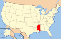
 Location in the U.S. state of Mississippi |
|
 Mississippi's location in the U.S. |
|
| Founded | 1802 |
| Named for | James Wilkinson |
| Seat | Woodville |
| Largest town | Centreville |
| Area | |
| • Total | 688 sq mi (1,782 km2) |
| • Land | 678 sq mi (1,756 km2) |
| • Water | 9.7 sq mi (25 km2), 1.4% |
| Population | |
| • (2010) | 9,878 |
| • Density | 15/sq mi (6/km²) |
| Congressional district | 3rd |
| Time zone | Central: UTC-6/-5 |
| Website | www |
Wilkinson County is a county located in the U.S. state of Mississippi. As of the 2010 census, the population was 9,878. Its county seat is Woodville. The county is named for James Wilkinson, a Revolutionary War military leader and first governor of the Louisiana Territory after its acquisition by the United States in 1803.
In the nineteenth century, this county was developed by European-American settlers as cotton plantations along the Mississippi River, which forms the western border of the county. Much of the bottomlands and interior were undeveloped frontier until after the American Civil War. The intensive cultivation depended on the labor of numerous enslaved African Americans; in the early nineteenth century, more than a million were transported here from the Upper South in a major forced migration. The population of this county quickly became majority black as workers were brought in.
The West Feliciana Railroad was later built to help get the cotton commodity crop to market. Some planters got wealthy during the antebellum years and built fine mansions in the county seat of Woodville, Mississippi. After the Civil War, freedmen and planters negotiated new working arrangements, and sharecropping became widespread.
...
Wikipedia
