Wicomico River (Potomac River)
| Wicomico River | |
|---|---|

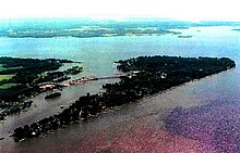
Cobb Island, MD is at the junction of Neale Sound, Wicomico River, and the Potomac River
|
|
| Country | United States |
| State | Maryland |
| Basin features | |
| River mouth |
Potomac River 0 feet (0 m) |
| Physical characteristics | |
| Length | 13.0 miles (20.9 km) |
The Wicomico River is a 13.0-mile-long (20.9 km)tributary of the lower tidal portion of the Potomac River located in the U.S. state of Maryland south of Washington, DC. The river empties into the Potomac at Cobb Island and St. Margaret's Island. Its watershed area (excluding water) is 77 square miles (200 km2), with 2% impervious surface in 1994. in Charles, St. Mary's, and southern Prince George's counties. The lower section of the river forms part of the boundary between Charles and St. Mary's counties. The Wicomico River was designated a Scenic River under the Maryland Scenic River Act in 1968, and there are Scenic River Commissions for it in both Charles and St. Mary's counties (see links below).
Coordinates: 38°17′12″N 76°49′37″W / 38.28667°N 76.82694°W
...
Wikipedia
