Wicomico County
| Wicomico County, Maryland | |||
|---|---|---|---|
|
|||
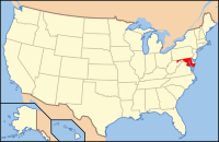
 Location in the U.S. state of Maryland |
|||
 Maryland's location in the U.S. |
|||
| Founded | 1867 | ||
| Named for | Wicomico River | ||
| Seat | Salisbury | ||
| Largest city | Salisbury | ||
| Area | |||
| • Total | 400 sq mi (1,036 km2) | ||
| • Land | 374 sq mi (969 km2) | ||
| • Water | 26 sq mi (67 km2), 6.4% | ||
| Population (est.) | |||
| • (2015) | 102,370 | ||
| • Density | 256/sq mi (99/km²) | ||
| Congressional district | 1st | ||
| Time zone | Eastern: UTC-5/-4 | ||
| Website | www |
||
Wicomico County (/waɪˈkɒmᵻkoʊ/) is a county located in the southeastern part of the U.S. state of Maryland. As of the 2010 census, the population was 98,733. The county seat is Salisbury. The county was named for the Wicomico River, which in turn derives from Algonquian language words wicko mekee, meaning "a place where houses are built," apparently referring to an Indian town on the banks.
Wicomico County is included in the Salisbury, MD-DE Metropolitan Statistical Area.
The newspaper of record is The Daily Times.
Wicomico County was created from Somerset and Worcester counties in 1867.
Wicomico County was granted a charter form of government in 1964. The county is solidly Republican: no Democrat has won Wicomico County since Lyndon Johnson’s landslide in 1964.
The legislative functions of government are vested in the County Council. The County Council consists of seven members, five of whom are elected from individual districts; the other two are elected at-large. Councilman John Cannon is the current Council President.
...
Wikipedia


