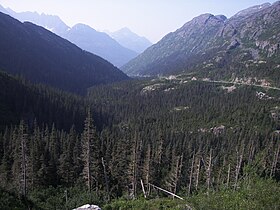
White Pass
| White Pass | |
|---|---|
 |
|
| Elevation | 873 m (2,864 ft) |
| Location | Atlin District, Canada / Municipality of Skagway Borough, Alaska, United States |
| Range | Boundary Ranges |
| Coordinates | 59°37′29″N 135°08′17″W / 59.62472°N 135.13806°W |
White Pass, also known as the Dead Horse Trail, (el. 873 m or 2,864 ft) is a mountain pass through the Boundary Ranges of the Coast Mountains on the border of the U.S. state of Alaska and the province of British Columbia, Canada. It leads from Skagway, Alaska, to the chain of lakes at the headwaters of the Yukon River, Crater Lake, Lake Lindeman, and Bennett Lake.
The White Pass was closely controlled by the Chilkoot Indians and was unknown to non-natives until 1887. William Ogilvie had heard reports of a low pass from the head of Chilkoot Inlet to the headwaters of the Lewes River (Yukon River), while in Juneau. In June 1887, Ogilvie was at the head of Taiya Inlet doing a survey from Pyramid Island up through the Chilkoot Pass. William Moore, who was accompanying him, had experience building roads in mountainous areas and wanted to try this route since the Chilkoot Pass was reported to be too steep for a wagon road. Ogilvie made inquiries and learned there was such a pass, but could not induce any Chilkoots to guide Moore. Skookum Jim Mason had been through this low-altitude pass before, and with much talk and encouragement, he was induced to reveal it. Ogilvie sent Moore and Skookum Jim Mason over this low altitude pass while he continued with his surveying work on the Chilkoot Pass. Moore did a rough survey of the new pass and returned with the satisfaction that he had found the route for his wagon road. The White Pass was named for the Canadian Minister of the Interior Thomas White by William Ogilvie.
...
Wikipedia
