White Deer Township, Union County, Pennsylvania
| White Deer Township, Pennsylvania | |
|---|---|
| Township | |

An old red barn in White Deer Township
|
|
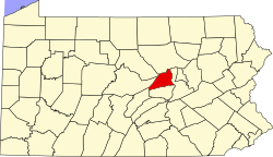
 Map of Union County, Pennsylvania highlighting White Deer Township |
|
 Map of Pennsylvania highlighting Union County |
|
| Country | United States |
| State | Pennsylvania |
| County | Union |
| Settled | 1772 |
| Incorporated | 1776 |
| Area | |
| • Total | 46.6 sq mi (120.7 km2) |
| • Land | 46.5 sq mi (120.4 km2) |
| • Water | 0.1 sq mi (0.3 km2) |
| Population (2010) | |
| • Total | 1,047 |
| • Estimate (2016) | 4,598 |
| • Density | 91.9/sq mi (35.5/km2) |
| Time zone | EST (UTC-5) |
| • Summer (DST) | EDT (UTC-4) |
| FIPS code | 42-119-84496 |
White Deer Township is a township in Union County, Pennsylvania, United States. The population was 4,273 at the 2000 census.
The Watsontown River Bridge and Factory Bridge are listed on the National Register of Historic Places.
According to the United States Census Bureau, the township has a total area of 46.6 square miles (120.7 km²), of which, 46.5 square miles (120.4 km²) of it is land and 0.1 square miles (0.3 km²) of it (0.21%) is water.
White Deer Township is bordered by Lycoming County and Gregg Township to the north, the West Branch Susquehanna River to the east over which lies Northumberland County, Kelly and Buffalo Townships to the south and West Buffalo Township to the west. Within White Deer Township are the unincorporated communities of White Deer and New Columbia, plus a portion of West Milton.
As of the census of 2000, there were 4,273 people, 1,644 households, and 1,269 families residing in the township. The population density was 91.9 people per square mile (35.5/km²). There were 1,734 housing units at an average density of 37.3/sq mi (14.4/km²). The racial makeup of the township was 98.15% White, 0.61% African American, 0.21% Asian, 0.26% from other races, and 0.77% from two or more races. Hispanic or Latino of any race were 0.70% of the population.
...
Wikipedia
