White Cloud, Kansas
| White Cloud, Kansas | |
|---|---|
| City | |

White Cloud (1974)
|
|
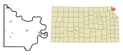
 Location within Doniphan County and Kansas |
|
 KDOT map of Doniphan County (legend) |
|
| Coordinates: 39°58′38″N 95°18′0″W / 39.97722°N 95.30000°WCoordinates: 39°58′38″N 95°18′0″W / 39.97722°N 95.30000°W | |
| Country | United States |
| State | Kansas |
| County | Doniphan |
| Government | |
| • Mayor | Kim Tilton |
| Area | |
| • Total | 0.73 sq mi (1.89 km2) |
| • Land | 0.73 sq mi (1.89 km2) |
| • Water | 0 sq mi (0 km2) |
| Elevation | 883 ft (269 m) |
| Population (2010) | |
| • Total | 176 |
| • Estimate (2015) | 174 |
| • Density | 240/sq mi (93/km2) |
| Time zone | Central (CST) (UTC-6) |
| • Summer (DST) | CDT (UTC-5) |
| ZIP code | 66094 |
| Area code(s) | 785 |
| FIPS code | 20-77850 |
| GNIS feature ID | 0472799 |
White Cloud (Ioway: Chína Maxúthga pronounced [tʃʰiꜜnã mãxuθꜜkɐ] or Chína Maxúhga pronounced [tʃʰiꜜnã mãxuhꜜkɐ], meaning "Village Cloud-White") is a city in Doniphan County, Kansas, United States. It was named for James White Cloud, son of Chief White Cloud of the Iowa people. As of the 2010 census, the city population was 176. White Cloud is the seat of government for the Iowa Tribe of Kansas and Nebraska.
The first post office at White Cloud was established in July, 1855.
In 1857, the town site was purchased by John Utt and Enoch Spaulding, two land promoters from Oregon, Missouri, who then sold lots in the town. White Cloud prospered by taking advantage of steamboat traffic on the nearby Missouri River.
In 1913, ten-year-old Wilbur Chapman of White Cloud gained widespread publicity after raising and selling a pig for $25.00, which he donated to the American Mission to Lepers. An obelisk-shaped monument was installed in front of the Community Christian Church in White Cloud in Chapman's honor.
Some scenes from the 1973 movie Paper Moon were filmed in White Cloud. White Cloud is featured in episode 4 of the 2008 television documentary Stephen Fry in America.
The entire downtown district of White Cloud is listed on the National Register of Historic Places, as are the Poulet House and the White Cloud School.
White Cloud is located at 39°58′38″N 95°18′00″W / 39.977348°N 95.299888°W (39.977348, -95.299888). According to the United States Census Bureau, the city has a total area of 0.73 square miles (1.89 km2), all land.
...
Wikipedia
