Westwood, New Jersey
| Westwood, New Jersey | |
|---|---|
| Borough | |
| Borough of Westwood | |

Westwood Gazebo in 2014
|
|
| Motto: "Hub of the Pascack Valley" | |
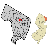
 Map highlighting Westwood's location within Bergen County. Inset: Bergen County's location within New Jersey. |
|
 Census Bureau map of Westwood, New Jersey |
|
| Coordinates: 40°59′21″N 74°01′55″W / 40.989032°N 74.031872°WCoordinates: 40°59′21″N 74°01′55″W / 40.989032°N 74.031872°W | |
| Country | |
| State |
|
| County | Bergen |
| Incorporated | May 8, 1894 |
| Government | |
| • Type | Borough |
| • Body | Borough Council |
| • Mayor | John Birkner Jr. (term ends December 31, 2019) |
| • Administrator | Ben Kezmarsky |
| • Clerk | Karen Hughes |
| Area | |
| • Total | 2.314 sq mi (5.992 km2) |
| • Land | 2.266 sq mi (5.868 km2) |
| • Water | 0.048 sq mi (0.124 km2) 2.07% |
| Area rank | 387th of 566 in state 42nd of 70 in county |
| Elevation | 66 ft (20 m) |
| Population (2010 Census) | |
| • Total | 10,908 |
| • Estimate (2015) | 11,247 |
| • Rank | 224th of 566 in state 33rd of 70 in county |
| • Density | 4,814.5/sq mi (1,858.9/km2) |
| • Density rank | 115th of 566 in state 29th of 70 in county |
| Time zone | Eastern (EST) (UTC-5) |
| • Summer (DST) | Eastern (EDT) (UTC-4) |
| ZIP codes | 07675, 07677 |
| Area code(s) | 201 |
| FIPS code | 3400380270 |
| GNIS feature ID | 0885442 |
| Website | www |
Westwood (known as "The Hub of the Pascack Valley") is a borough in Bergen County, New Jersey, United States. As of the 2010 United States Census, the borough's population was 10,908, reflecting a decline of 91 (-0.8%) from the 10,999 counted in the 2000 Census, which had in turn increased by 553 (+5.3%) from the 10,446 counted in the 1990 Census. Westwood is part of the New York metropolitan area. Many of its residents regularly commute to New York City for work and leisure, many using public transportation.
Westwood was officially incorporated as a borough on May 8, 1894, from portions of Washington Township, early during the "Boroughitis" phenomenon then sweeping through Bergen County, in which 26 boroughs were formed in the county in 1894 alone. Isaac D. Bogert served as the first mayor of the Borough. In April 1909, Westwood was enlarged through the annexation of the "Old Hook" section of the borough of Emerson, and on September 24, 1957, portions of the borough were exchanged with Emerson.
The Lenni-Lenape Native Americans inhabited this part of the state and shared it with the transient hunters and trappers until the permanent settlers began to enter in mid-18th century. In the early 19th century, the area that would later become Westwood was within the larger political boundaries of Harrington Township, which had been established by royal charter in 1775. In 1840, the western half of Harrington Township became Washington Township, with the Hackensack River as the dividing line. Washington Township was an agrarian region with isolated farmsteads. Early families, including the Hoppers and Ackermans, are buried at the Old Hook Cemetery. An 18th-century mill was situated at the dammed stream near the intersection of today's Mill Street and First Avenue. This mill was on an important east west pathway and was the first on Musquapsink Brook. The mill was largely destroyed after a fire set by an arsonist and was dismantled in 1910.
...
Wikipedia
