Weston, Ohio
| Weston, Ohio | |
|---|---|
| Village | |

Local businesses in downtown Weston
|
|
 Location of Weston, Ohio |
|
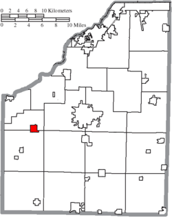
 Location of Weston in Wood County |
|
| Coordinates: 41°20′45″N 83°47′40″W / 41.34583°N 83.79444°WCoordinates: 41°20′45″N 83°47′40″W / 41.34583°N 83.79444°W | |
| Country | United States |
| State | Ohio |
| County | Wood |
| Government | |
| • Mayor | Jeremy R. Schroeder |
| Area | |
| • Total | 1.13 sq mi (2.93 km2) |
| • Land | 1.13 sq mi (2.93 km2) |
| • Water | 0 sq mi (0 km2) |
| Population (2010) | |
| • Total | 1,590 |
| • Estimate (2012) | 1,610 |
| • Density | 1,407.1/sq mi (543.3/km2) |
| Time zone | Eastern (EST) (UTC-5) |
| • Summer (DST) | EDT (UTC-4) |
| ZIP code | 43569 |
| Area code(s) | 419 |
| Website | http://www.westonohio.org/ |
Weston is a village in Wood County, Ohio, United States. The population was 1,590 at the 2010 census. Weston is located just 10 miles west of Bowling Green, Ohio, a university town.
Weston was originally called Taylortown, and under the latter name was platted in 1853 by Thomas Taylor, and named for him. Another early variant name was New Westfield. The present name is from Weston Township. A post office called New Westfield was established in 1856, and the name was changed to Weston in 1863. The village was incorporated in 1873.
Weston is located at 41°20′45″N 83°47′40″W / 41.34583°N 83.79444°W (41.345806, -83.794543).
According to the United States Census Bureau, the village has a total area of 1.13 square miles (2.93 km2), all land.
As of the census of 2010, there were 1,590 people, 609 households, and 424 families residing in the village. The population density was 1,407.1 inhabitants per square mile (543.3/km2). There were 700 housing units at an average density of 619.5 per square mile (239.2/km2). The racial makeup of the village was 91.6% White, 0.1% African American, 1.0% Native American, 0.1% Asian, 4.8% from other races, and 2.4% from two or more races. Hispanic or Latino of any race were 11.8% of the population.
...
Wikipedia
