Westfield, New Brunswick
| Grand Bay–Westfield | ||
|---|---|---|
| Town | ||

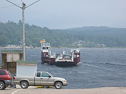
Cable ferry at Westfield, Brundage Point
|
||
|
||
| Motto: A Community of Friends | ||
| Coordinates: 45°21′39″N 66°14′29″W / 45.36075°N 66.24151°WCoordinates: 45°21′39″N 66°14′29″W / 45.36075°N 66.24151°W | ||
| Country | Canada | |
| Province | New Brunswick | |
| County | Kings County, | |
| Incorporated | January 1, 1998 | |
| Government | ||
| • Type | Town Council | |
| • Mayor | Grace Losier | |
| • Deputy Mayor | Michael Likely | |
| • Councillors | Beverley Day, John Balemans, Steve Evans, Ryan Snodgrass | |
| Area | ||
| • Total | 59.86 km2 (23.11 sq mi) | |
| Population (2011) | ||
| • Total | 5,117 | |
| • Density | 85.5/km2 (221/sq mi) | |
| Time zone | AST (UTC-4) | |
| • Summer (DST) | ADT (UTC-3) | |
| Canadian postal code | E5K | |
| Area code(s) | 506 | |
| Telephone Exchange | 217, 738, 757 | |
| NTS Map | 021G08 | |
| GNBC Code | DBEFJ | |
| Website | town.grandbay-westfield.nb.ca | |
Grand Bay–Westfield (2011 population: 5,117) is a Canadian suburb outside of Saint John in the western part of Kings County, New Brunswick.
The town is an amalgamation of the original town of Grand Bay and the neighbouring village of Westfield immediately to the north.
Grand Bay–Westfield is situated on the west bank of the Saint John River immediately north of the boundary between Kings County and Saint John County. The town is a suburb of the city of Saint John and its population is split with 3,405 residents in the Grand Bay neighbourhood and 1,544 located in Westfield.
Many residents of Grand Bay–Westfield find employment in Saint John; many are tradespeople who work at the Point Lepreau Nuclear Generating Station, or the Coleson Cove Generating Station, as well as various J.D. Irving Limited pulp and paper factories and the Moosehead brewery - all located on the west side of the city.
The area was discovered by Samuel de Champlain, who named Grand Bay (Grande Baie) for its wide view. Westfield is either named after Westfield, MA, where some of its settlers came from, or for its geographic location on the west shore of the Saint John River and Nerepis River. The area started out as "cottage country" for the Saint John area, and remained so for a long time (and is still considered to be so by some). Due to the steep hills and rock, the area never became heavily engaged in agriculture, although some did exist and still does.
The two municipal governments were merged in 1998 with the new municipality occupying much of the western portion of King's County.
...
Wikipedia


