Westbrook, Connecticut
| Westbrook, Connecticut | ||
|---|---|---|
| Town | ||

Town library, about 1906
|
||
|
||
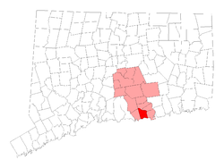
 Location within Middlesex County, Connecticut |
||
| Coordinates: 41°18′N 72°28′W / 41.300°N 72.467°WCoordinates: 41°18′N 72°28′W / 41.300°N 72.467°W | ||
| Country | United States | |
| State | Connecticut | |
| NECTA | New Haven | |
| Region | Connecticut River Estuary | |
| Incorporated | 1840 | |
| Government | ||
| • Type | Selectman-town meeting | |
| • First selectman | Noel Bishop (R) | |
| • Selectman | John Hall (R) | |
| • Selectman | Mary Labbadia (D) | |
| Area | ||
| • Total | 21.4 sq mi (55.4 km2) | |
| • Land | 15.7 sq mi (40.7 km2) | |
| • Water | 5.7 sq mi (14.7 km2) | |
| Elevation | 43 ft (13 m) | |
| Population (2010) | ||
| • Total | 6,938 | |
| • Density | 420/sq mi (162/km2) | |
| Time zone | Eastern (UTC-5) | |
| • Summer (DST) | Eastern (UTC-4) | |
| ZIP code | 06498 | |
| Area code(s) | 860 | |
| FIPS code | 09-81680 | |
| GNIS feature ID | 0213528 | |
| Website | http://www.westbrookct.us/ | |
Westbrook is a town in Middlesex County, Connecticut, United States. The population was 6,938 at the 2010 census. The town center is also classified by the U.S. Census Bureau as a census-designated place (CDP).
Westbrook lies in the shoreline area of the state. The town is bordered by the towns of Essex, Clinton, Deep River, and Old Saybrook, where the Connecticut River empties into Long Island Sound. The Salt Meadow Unit of the Stewart B. McKinney National Wildlife Refuge is located in town.
According to the United States Census Bureau, the town has a total area of 21.4 square miles (55 km2), of which, 15.7 square miles (41 km2) is land and 5.7 square miles (15 km2) (26.47%) is water. The CDP has a total area of 2.2 square miles (5.7 km2) of which 22.33% is water.
Westbrook encompasses three islands in Long Island Sound, all of which are uninhabited. Salt Island is the easternmost and smallest, at approximately 0.9 acres. Menunketesuck Island, which is the largest of Westbrook's islands at approximately 4.6 acres, extends into the Sound from the outlet of the Menunketesuck and Patchogue Rivers and is part of the Stewart B. McKinney National Wildlife Refuge. Further west is Duck Island, measuring approximately 3.6 acres.
Private beach Associations in the town are: Chapman Beach, Coral Sands, Grove Beach Point, Grove Beach Terrace, Horse Hill, Island View, Kelsey Point, Little Stannard, Middle Beach, Pilot's Point, Pointina, Quotonset Beach, Sagamore Terrace, Salt Works, Stannard Beach, West Beach.
...
Wikipedia

