West Yellowstone
| West Yellowstone | ||
|---|---|---|
| Town | ||

Yellowstone Avenue in winter
|
||
|
||
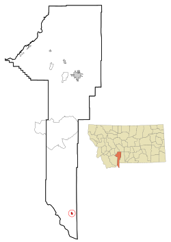
 Location of West Yellowstone within Gallatin County |
||
| Coordinates: 44°39′45″N 111°6′21″W / 44.66250°N 111.10583°WCoordinates: 44°39′45″N 111°6′21″W / 44.66250°N 111.10583°W | ||
| Country |
|
|
| State |
|
|
| County | Gallatin | |
| First Settled | November 12, 1907 | |
| Incorporated | June 6, 1966 | |
| Founded by | E.H. Harriman | |
| Named for | Yellowstone National Park | |
| Government | ||
| • Town Manager | Daniel Sabolsky | |
| • Mayor | Jerry Johnson | |
| Area | ||
| • Total | 0.80 sq mi (2.1 km2) | |
| • Land | 0.80 sq mi (2.1 km2) | |
| • Water | 0 sq mi (0 km2) | |
| Elevation | 6,667 ft (2,032 m) | |
| Population (2010) | ||
| • Total | 1,271 | |
| • Estimate (2015) | 1,339 | |
| • Density | 1,600/sq mi (610/km2) | |
| Time zone | Mountain (UTC-7) | |
| • Summer (DST) | Mountain (UTC-6) | |
| ZIP Code | 59758 | |
| Area code(s) | 406 | |
| Website | www |
|
West Yellowstone is a town in Gallatin County, Montana, adjacent to Yellowstone National Park. The population was 1,271 at the 2010 census. The town is served by Yellowstone Airport. It is part of the Bozeman, MT Micropolitan Statistical Area. It was founded in June 1908 when the Oregon Short Line Railroad was completed. The town's name changed several times until West Yellowstone was settled upon in 1920.
For many, the town of West Yellowstone is a place to stay while traveling through Yellowstone National Park. The town is separated into two parts, residential and commercial, roughly at the road D Parkway. South of D Parkway (Alley) is mainly a business area; north of it is an area of homes and apartments. The area north of D Parkway is known to locals as the "Madison Addition". The town has one school, serving kindergarten through 12th grade.
As of the census of 2010, there were 1,271 people, 617 households, and 298 families residing in the town. The population density was 1,588.8 inhabitants per square mile (613.4/km2). There were 969 housing units at an average density of 1,211.3 per square mile (467.7/km2). The racial makeup of the town was 86.6% White, 0.4% African American, 1.1% Native American, 0.9% Asian, 7.5% from other races, and 3.5% from two or more races. Hispanic or Latino of any race were 17.9% of the population.
...
Wikipedia

