West Tamar
|
West Tamar Council Tasmania |
|||||||||||||||
|---|---|---|---|---|---|---|---|---|---|---|---|---|---|---|---|

West Tamar LGA in Tasmania
|
|||||||||||||||
| Coordinates | 41°16′12″S 146°52′48″E / 41.27000°S 146.88000°ECoordinates: 41°16′12″S 146°52′48″E / 41.27000°S 146.88000°E | ||||||||||||||
| Population | 23,202 (2015 est.) | ||||||||||||||
| • Density | 33.675/km2 (87.22/sq mi) | ||||||||||||||
| Area | 689 km2 (266.0 sq mi) | ||||||||||||||
| Mayor | Christina Holmdahl | ||||||||||||||
| Council seat | Beaconsfield | ||||||||||||||
| Region | Western Tamar Valley | ||||||||||||||
| State electorate(s) | Bass | ||||||||||||||
| Federal Division(s) | Bass | ||||||||||||||
 |
|||||||||||||||
| Website | West Tamar Council | ||||||||||||||
|
|||||||||||||||
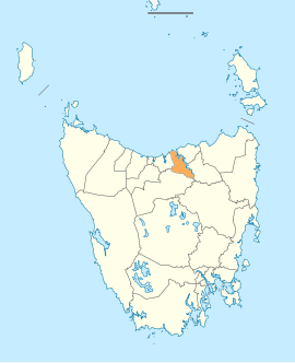
The West Tamar Council is a local government area of Tasmania, Australia. It covers almost all of the western shore of the Tamar River, from Bass Strait in the north, down to Launceston in the south.
The municipal area starts with the Launceston suburb of Riverside in the south; the satellite suburb of Legana; the towns of Exeter, Beaconsfield and Beauty Point, all the way up to the beach resort town of Greens Beach at the mouth of the Tamar River.
In 2006, West Tamar Council had one of the highest birth rates in Australia, with a TFR of 3.12 children per woman.
...
Wikipedia
