West Jefferson, Ohio
| West Jefferson, Ohio | |
|---|---|
| Village | |

|
|
 Location of West Jefferson, Ohio |
|
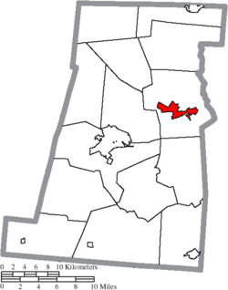
 Location of West Jefferson in Madison County |
|
| Coordinates: 39°56′36″N 83°16′33″W / 39.94333°N 83.27583°WCoordinates: 39°56′36″N 83°16′33″W / 39.94333°N 83.27583°W | |
| Country | United States |
| State | Ohio |
| County | Madison |
| Government | |
| • Mayor | Darlene Steele |
| Area | |
| • Total | 4.87 sq mi (12.61 km2) |
| • Land | 4.85 sq mi (12.56 km2) |
| • Water | 0.02 sq mi (0.05 km2) |
| Population (2010) | |
| • Total | 4,222 |
| • Estimate (2012) | 4,199 |
| • Density | 870.5/sq mi (336.1/km2) |
| Time zone | Eastern (EST) (UTC-5) |
| • Summer (DST) | EDT (UTC-4) |
| ZIP code | 43162 |
| Area code(s) | 614 |
| Website | www.villageofwestjefferson.com |
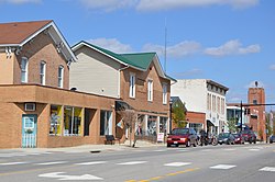
West Jefferson is a village in Madison County, Ohio, United States. The population was 4,222 at the 2010 census. Located along U.S. Route 40, the village has a fairly close relationship with the surrounding township, which include various out-of-corporation-limit neighborhoods (including Haymarket Road, Olmstead Road, Forrest Lake Estates, Goodson Road/Enchanted Valley, and North and South Road). The village boasts a "Commerce Park" at its western edge which includes a Target Distribution Center, a Krazy Glue factory, and Jefferson Industries.
West Jefferson was originally called New Hampton, and under the latter name was platted c. 1831. A post office called West Jefferson has been in operation since 1833.
West Jefferson is located at 39°56′36″N 83°16′33″W / 39.94333°N 83.27583°W (39.943244, −83.275855).
According to the United States Census Bureau, the village has a total area of 4.87 square miles (12.61 km2), of which 4.85 square miles (12.56 km2) is land and 0.02 square miles (0.05 km2) is water.
As of the census of 2010, there were 4,222 people, 1,617 households, and 1,149 families residing in the village. The population density was 870.5 inhabitants per square mile (336.1/km2). There were 1,709 housing units at an average density of 352.4 per square mile (136.1/km2). The racial makeup of the village was 97.6% White, 0.5% African American, 0.3% Asian, 0.2% from other races, and 1.4% from two or more races. Hispanic or Latino of any race were 0.9% of the population.
...
Wikipedia
