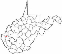
West Hamlin, West Virginia
| West Hamlin, West Virginia | |
|---|---|
| Town | |
| Motto: Always Free | |
 Location of West Hamlin, West Virginia |
|
| Coordinates: 38°17′8″N 82°11′31″W / 38.28556°N 82.19194°WCoordinates: 38°17′8″N 82°11′31″W / 38.28556°N 82.19194°W | |
| Country | United States |
| State | West Virginia |
| County | Lincoln |
| Government | |
| • Type | Mayor- Farris Burton |
| • Recorder | Joanna Caldwell |
| • Water Sup. | Lonnie Wilson |
| Area | |
| • Total | 0.55 sq mi (1.42 km2) |
| • Land | 0.53 sq mi (1.37 km2) |
| • Water | 0.02 sq mi (0.05 km2) |
| Elevation | 587 ft (179 m) |
| Population (2010) | |
| • Total | 774 |
| • Estimate (2012) | 767 |
| • Density | 1,460.4/sq mi (563.9/km2) |
| Time zone | Eastern (EST) (UTC-5) |
| • Summer (DST) | EDT (UTC-4) |
| ZIP code | 25571 |
| Area code(s) | 304 |
| FIPS code | 54-85804 |
| GNIS feature ID | 1548934 |
West Hamlin is a town in Lincoln County, West Virginia, United States, along the Guyandotte River. The population was 774 at the 2010 census. West Hamlin is a part of the Huntington-Ashland, WV-KY-OH, Metropolitan Statistical Area (MSA). As of the 2010 census, the MSA had a population of 287,702. New estimates from February 28, 2013 placed the population at 363,000. West Hamlin is west of the county seat at Hamlin, hence the name.
West Hamlin is located at 38°17′8″N 82°11′31″W / 38.28556°N 82.19194°W (38.285461, -82.191991).
According to the United States Census Bureau, the town has a total area of 0.55 square miles (1.42 km2), of which, 0.53 square miles (1.37 km2) is land and 0.02 square miles (0.05 km2) is water.
As of the census of 2010, there were 774 people, 356 households, and 211 families residing in the town. The population density was 1,460.4 inhabitants per square mile (563.9/km2). There were 395 housing units at an average density of 745.3 per square mile (287.8/km2). The racial makeup of the town was 98.3% White, 0.1% African American, and 1.6% from two or more races. Hispanic or Latino of any race were 0.9% of the population.
...
Wikipedia
