West-Staaken
| Staaken | |
|---|---|
| Quarter of Berlin | |

Village church with commemoration cross to Staaken's division from 1951 to 1990
|
|
| Coordinates: 52°31′57″N 13°08′29″E / 52.53250°N 13.14139°ECoordinates: 52°31′57″N 13°08′29″E / 52.53250°N 13.14139°E | |
| Country | Germany |
| State | Berlin |
| City | Berlin |
| Borough | Spandau |
| Founded | 1273 |
| Area | |
| • Total | 10.9 km2 (4.2 sq mi) |
| Population (2008-06-30) | |
| • Total | 41,470 |
| • Density | 3,800/km2 (9,900/sq mi) |
| Time zone | CET/CEST (UTC+1/+2) |
| Postal codes | (nr. 0504) 13591 |
| Vehicle registration | B |
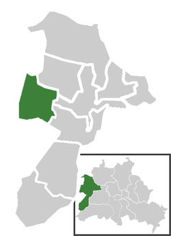
Staaken is a locality at the western rim of Berlin within the borough of Spandau.
Staaken borders on the localities of Spandau proper, Falkenhagener Feld and Wilhelmstadt. In the west it shares border with the Brandenburg municipalities of Falkensee and Dallgow-Döberitz with the village of Seeburg, part of Havelland district. Buildings range from small detached houses and a garden city around the historic village centre in the west to larger 1960s and 1970s housing estates in the east.
The locality of Staaken includes six sites (German: Ortslagen) or neighbourhoods (Siedlungen):
Staaken is served by RegionalExpress and RegionalBahn trains of the Deutsche Bahn AG at the stations Staaken and Albrechtshof. A S-Bahn connection to Albrechtshof is planned. The Bundesstraße 5 federal highway runs through the locality along Heerstraße.
First mentioned in a 1273 deed as Stakene (from Middle Low German: staken, "stakes") in the Mittelmark region of the Margraviate of Brandenburg, the linear settlement probably arose around 1200 in the course of the German eastward migration. The estates were then held by the Benedictine nunnery of Spandau; after the Protestant Reformation they fell to the Spandau municipal administration.
...
Wikipedia


