Wendelstein (mountain)
| Wendelstein | |
|---|---|

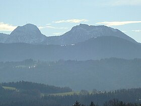
The Wendelstein (l) from the north. To its right is the Breitenstein.
|
|
| Highest point | |
| Elevation | 1,838 m (6,030 ft) |
| Prominence | 740 metres (2,430 ft) |
| Isolation | 6.58 kilometres (4.09 mi) |
| Coordinates | 47°42′10″N 12°00′44″E / 47.70278°N 12.01222°ECoordinates: 47°42′10″N 12°00′44″E / 47.70278°N 12.01222°E |
| Geography | |
| Parent range | Mangfall Mountains, Bavarian Pre-Alps |
| Geology | |
| Age of rock | Triassic |
| Mountain type | Wetterstein limestone |
| Climbing | |
| First ascent | unknown |
| Access | |
The Wendelstein is a 1,838-metre-high (6,030 ft) mountain in the Bavarian Alps in South Germany. It belongs to the so-called Mangfall Mountains, the eastern part of the Bavarian Pre-Alps. It is the highest peak in the Wendelstein massif. Due to its exposed location it has a very good view over the Bavarian Alpine Foreland and is unmistakable for miles around. It lies between the valleys of the Leitzach and Inn and is accessible via the Wendelstein Cable Car and the Wendelstein Rack Railway. On its northern foothills rises the Jenbach, which becomes the Kalten on its way to the River Mangfall.
Local valley settlements include Bayrischzell, Brannenburg (rack railway) and Osterhofen (cable car).
The mountain consists mainly of Wetterstein limestone from the Upper Triassic with dasycladales - marine algae whose natural habitat is shallow lagoons in tropical climates. The colour of the rock varies between grey white and light grey to speckled.
The Wendelstein seen from the west
The Wendelstein from the south
Wendelstein's BR transmission mast
View from Bayrischzell of the summit
The annual precipitation is 1,714 mm (67.5 in), which is extremely high, lying in the upper twentieth of values in Germany. 99% of German Met Office weather stations register lower values. The driest month is October, the wettest is July, which experiences 2.6 times as much precipitation as October. Annual variations are extremely large. Only 3% of weather stations register higher annual variations.
On the summit of the mountain is the Wendelstein Chapel, an observatory, a weather station, a geopark and a transmission mast for the Bayerischer Rundfunk that can be seen from a long way off. About one hundred metres below the summit, on the ridge between the Wendelstein and the Schwaigerwand, lie the mountain inn, the termini of the rack railway and cable car, the service building for the mast, the former mountain hotel (above the station), a hut for the mountain rescue service and the well-known Wendelstein Church.
...
Wikipedia

