Wells, British Columbia
| Wells | |
|---|---|
| District municipality | |
| District of Wells | |
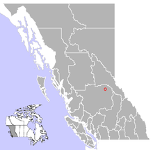
 Location of Wells in British Columbia |
|
| Coordinates: 53°06′06″N 121°34′32″W / 53.10167°N 121.57556°WCoordinates: 53°06′06″N 121°34′32″W / 53.10167°N 121.57556°W | |
| Country |
|
| Province |
|
| Region | Cariboo |
| Regional district | Cariboo Regional District |
| Incorporated | 1998 |
| Government | |
| • Governing body | Wells Council |
| Area | |
| • Total | 158.28 km2 (61.11 sq mi) |
| Elevation | 1,200 m (3,900 ft) |
| Population (2011) | |
| • Total | 245 |
| • Density | 1.5/km2 (4/sq mi) |
| Time zone | PST (UTC-8) |
| Highways | 26 |
Wells is a small mining and tourist town in the Cariboo District of central British Columbia, located on BC Highway 26, 74 km from Quesnel and 8 km before the highway's terminus at Barkerville. It gains much of its revenue and jobs from tourists who pass through on their way to the Bowron Lake Provincial Park and to the historic museum town of Barkerville.
Originally a company town, was managed by Cariboo Gold Quartz Mine. At its heyday of the 1930s, Wells sported 4500 people. In 1942 it had a greater population than Quesnel or Prince George. The closure of the gold and other mineral mines in 1967 took its toll on the town and most of the population moved away. Today it has a listed population of just 300 which doubles during the summer months, and drops to roughly 100 during the winter.
Between May and September, Wells sees over 100,000 tourists pass through on their way to Barkerville. Most visitors stay or camp overnight in Wells, which has an active arts and outdoor adventure life of its own. During the winter months, visitors come for the world-class cross-country ski trails, snowmobiling, and artistic and study retreats. During the summer visitors enjoy galleries and live performances.
In 2012, All Roads Lead to Wells: Stories of the Hippie Days by Susan Safyan was published by Caitlin Press.
Wells was featured on the historical television series Gold Trails and Ghost Towns, Season 3, Episode 13.
...
Wikipedia
