Wellington, British Columbia
| Wellington | |
|---|---|
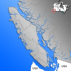
| Location of Wellington within the Nanaimo District on Vancouver Island | |
| Coordinates: 49°12′28″N 124°00′55″W / 49.20778°N 124.01528°WCoordinates: 49°12′28″N 124°00′55″W / 49.20778°N 124.01528°W | |
| Country |
|
| Province |
|
| Region | Vancouver Island |
| Regional district | Nanaimo Regional District |
| Elevation | 115 m (377 ft) |
| Population (2006) | |
| • Total | 3,935 (Diver Lake) |
| • Density | 988.1/km2 (2,559/sq mi) |
| Time zone | PST (UTC-8) |
| Website | http://www.wellingtonbc.ca |
Wellington is the name of a north Nanaimo, British Columbia neighbourhood, which was once the town of Wellington. The community was named for Arthur Wellesley, 1st Duke of Wellington.
Since amalgamation with Nanaimo, Wellington District is often referred to as "North Nanaimo" with the former townsites collectively keeping the neighbourhood name of "Wellington".
Wellington is located in a shared portion of the traditional territories of the Sneneymuxw and Nanoose First Nations. Both nations are Coast Salish and use the Halkomelem language. WIth their heavy seaworthy canoes, both groups were highly mobile traders and many would have used Chinook Jargon as a trading language.
Early photographs of Europeans standing for photo-ops in the distinctive Salish canoes on Long Lake show that the first nations and the Europeans coexisted in the Wellington area.
Prior to 1869 a small number of settlers had established farms around Diver Lake, Long Lake and Brannen Lake. The neighbourhood had a saloon and was connected to Nanaimo by a trail. With extensive marshes and lakes, the area was frequented by Nanaimo residents for fishing and hunting.
In 1869 Robert Dunsmuir discovered a thin surface seam coal on the roots of a fallen tree while visiting Diver Lake. Dunsmuir was a coal miner with a keen interest in operating his own mine and immediately investigated the coal seam. By 1871 Dunsmuir had discovered the Wellington coal seam which underlaid his initial discovery. Once Dunsmuir determined the Coal was of good quality and significant quantity, he established a company so that he could get a land grant for the area. This first grant covered most of what is today known as the Wellington Land District. Initially the town grew up along the crest of land which is now Jingle Pot Road.
By 1871 Dunsmuir had the new mine producing coal, and a company village had sprung up to provide labour for the Wellington mine. Wellington grew fast and by 1874 the School in Wellington had 90 pupils. The Wellington mine grew quickly and was soon outproducing the more established Vancouver Coal Company of Nanaimo. By the 1890s the town, with 5,000 residents, was the second largest city on Vancouver Island (after Victoria, the capital).
...
Wikipedia

