Weisshorn
| Weisshorn | |
|---|---|

North-east view of the Weisshorn
|
|
| Highest point | |
| Elevation | 4,506 m (14,783 ft) |
| Prominence | 1235 m ↓ Furggjoch |
| Isolation | 11.0 km → Dom |
| Parent peak | Monte Rosa |
| Coordinates | 46°06′06″N 7°42′58″E / 46.10167°N 7.71611°ECoordinates: 46°06′06″N 7°42′58″E / 46.10167°N 7.71611°E |
| Naming | |
| Translation | white peak/mountain |
| Geography | |
| Location | Valais, Switzerland |
| Parent range | Pennine Alps |
| Topo map | Swisstopo 1328 Randa |
| Climbing | |
| First ascent | 19 August 1861 by John Tyndall with guides J.J. Bennen and Ulrich Wenger |
| Easiest route | rock/snow/ice climb |
The Weisshorn (German, lit. white peak/mountain) is a major peak of the Alps and Switzerland, culminating at 4,506 metres (14,783 feet) above sea level. It is part of the Pennine Alps and is located between the valleys of Anniviers and Zermatt in the canton of Valais. In the latter valley, the Weisshorn is one of the many 4000ers surrounding Zermatt, with Monte Rosa and the Matterhorn.
The Weisshorn was first climbed in 1861 from Randa by the Irish physicist John Tyndall, accompanied by the guides J.J. Bennen and Ulrich Wenger. Nowadays, the Weisshorn Hut is used on the normal route. The Weisshorn is considered by many mountaineers to be the most beautiful mountain in the Alps and Switzerland for its pyramidal shape and pure white slopes.
In April and May 1991, two consecutive rockslides took place from a cliff above the town of Randa on the east side of the massif, below the Bis Glacier.
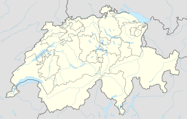
The Weisshorn is situated in the southern canton of Valais, about 25 km southwards from the Rhone between Sierre and Visp. It is the culminating point on the north-south orientated chain separating the Val d'Anniviers to the west and the Mattertal to the east and enclosing the Turtmanntal to the north, the tripoint between these valleys being located just north of its main summit. The Weisshorn faces the slightly higher Dom across the Mattertal, with the village of Randa 3100 metres below these two summits. After the Dom, the Weisshorn is the second-highest Alpine summit situated completely out the main chain and fully within Switzerland. On both sides of the Weisshorn range, the water end up in the Rhone, through the Navissence (west) and the Vispa (east). The Weisshorn and the Dom are only two of the many 4000-metre peaks surrounding the region of Zermatt, along with the Zinalrothorn, the Dent Blanche, the Dent d'Hérens, the Matterhorn and, second highest in the Alps, Monte Rosa.
...
Wikipedia

