Weishan Yi and Hui Autonomous County
|
Weishan County 巍山县 وِشًا |
|
|---|---|
| County | |
| [[File:Gong Chen Men in Weishan, Yunnan, China.jpg|280px|Gongchen Tower, atop the Gongchen Gate, is a symbol of Weishan]]
Gongchen Tower, atop the Gongchen Gate, is a symbol of Weishan
|
|
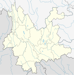
 Weishan County (pink) in Dali Bai Autonomous Prefecture (yellow), Yunnan (light grey) |
|
| Location in [[Yunnan, China]] | |
| Coordinates: 25°15′25.62″N 100°09′56.83″E / 25.2571167°N 100.1657861°E | |
| Country | China |
| Province | Yunnan |
| Prefecture | Dali |
| Area | |
| • Total | 2,200 km2 (800 sq mi) |
| Population (2010) | |
| • Total | 304,400 |
| • Density | 140/km2 (360/sq mi) |
| Postal code | 672400 |
| Area code(s) | 0872 |
| Climate | Cwb |
| Website | www |
Weishan Yi and Hui Autonomous County (Chinese: 巍山彝族回族自治县; pinyin: Wēishān Yízú Huízú Zìzhìxiàn; Xiao'erjing: وِشًا یِذُو خُوِذُو ذِجِشِیًا) is an autonomous county in the Dali Bai Autonomous Prefecture of Yunnan Province, China. It was known as Menghua (蒙化) until the 1950s.
It is situated in the upper section of the Ailao Mountains and the Wuliang Mountains.
Coordinates: 25°15′25.62″N 100°09′56.83″E / 25.2571167°N 100.1657861°E
...
Wikipedia

