Wayne, West Virginia
| Wayne, West Virginia | |
|---|---|
| Town | |

Hendrick Street in Wayne
|
|
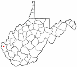
 Location of Wayne, West Virginia |
|
| Coordinates: 38°13′42″N 82°26′26″W / 38.22833°N 82.44056°WCoordinates: 38°13′42″N 82°26′26″W / 38.22833°N 82.44056°W | |
| Country | United States |
| State | West Virginia |
| County | Wayne |
| Trout's Hill (post office was Wayne Court House) | 1842 |
| Area | |
| • Total | 0.72 sq mi (1.86 km2) |
| • Land | 0.72 sq mi (1.86 km2) |
| • Water | 0 sq mi (0 km2) |
| Elevation | 696 ft (212 m) |
| Population (2010) | |
| • Total | 1,413 |
| • Estimate (2012) | 1,401 |
| • Density | 1,962.5/sq mi (757.7/km2) |
| Time zone | Eastern (EST) (UTC-5) |
| • Summer (DST) | EDT (UTC-4) |
| ZIP code | 25570 |
| Area code(s) | 304 |
| FIPS code | 54-84940 |
| GNIS feature ID | 1548850 |
Wayne is a town in Wayne County, West Virginia, United States. The population was 1,413 at the 2010 census. It is the county seat of Wayne County. Wayne is a part of the Huntington-Ashland, WV-KY-OH, Metropolitan Statistical Area. As of 2015, the MSA had a population of 361,580.
Wayne was established in 1842, by the same act of the Virginia General Assembly that created Wayne County. The county was named for General "Mad Anthony" Wayne. The town was initially known by the name "Trout's Hill," after Abraham Trout, who donated the land upon which the county's courthouse was built. The Wayne Courthouse Post Office was established in 1842 also. The town was known simultaneously as Trout's Hill and Wayne Courthouse for many years. The town was incorporated in 1860 and 1882 as Fairview, but was still commonly known as Wayne Courthouse. The population in 1882 was 157. In 1890, the Norfolk & Western Railroad was constructed up Twelve Pole Creek. The railroad placed the name "Wayne" on its schedule and the name caught on. The name was officially changed to Wayne in 1911.
Settlers arrived near the town of Wayne in the early 1800s. Abraham Trout began operating a mill where the town now stands in 1828 at a waterfall on Twelve Pole Creek. Later on, he built a mill dam.
By the 1830s, the population in western Cabell County was growing, and it became necessary to form a new county in the area. Initially, a group of men from the Big Sandy River attempted to get a county created in 1840 with the county seat at the forks of the Big Sandy River where present Fort Gay is now located but it failed. A year later, men from Twelve Pole began working toward a new county with the county seat near the forks of Twelve Pole Creek. They were successful, and the new county was established on January 18, 1842 and named after General Anthony Wayne.
...
Wikipedia
