Wauseon, Ohio
| Wauseon, Ohio | |
|---|---|
| City | |

Buildings in downtown Wauseon
|
|
| Motto: A City You'll Take To Heart | |
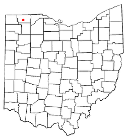
 Location of Wauseon, Ohio |
|
 Location of Wauseon in Fulton County |
|
| Coordinates: 41°33′8″N 84°8′21″W / 41.55222°N 84.13917°WCoordinates: 41°33′8″N 84°8′21″W / 41.55222°N 84.13917°W | |
| Country |
|
| State |
|
| County | Fulton |
| Township | Clinton |
| Government | |
| • Mayor | Kathy Huner |
| Area | |
| • Total | 5.19 sq mi (13.44 km2) |
| • Land | 5.17 sq mi (13.39 km2) |
| • Water | 0.02 sq mi (0.05 km2) |
| Elevation | 771 ft (235 m) |
| Population (2010) | |
| • Total | 7,332 |
| • Estimate (2015) | 7,316 |
| • Density | 1,418.2/sq mi (547.6/km2) |
| Time zone | Eastern (EST) (UTC-5) |
| • Summer (DST) | EDT (UTC-4) |
| ZIP code | 43567 |
| Area code(s) | 419 and 567 |
| FIPS code | 39-81928 |
| GNIS feature ID | 1047628 |
| Website | www |
Wauseon is a city in and the county seat of Fulton County, Ohio, United States. The population was 7,332 at the 2010 census. It was named after Wauseon, a Potawatomi Native American chief who lived in the area before the founding of the state.
The first seat of justice in the county was Ottokee, because of its central location in the county; a wooden courthouse was built in 1851. Wauseon was platted 1854 when the railroad was extended to that point. The village was incorporated in 1859. With the commercial success that the railroad brought to Wauseon, it was designated county seat in 1871. The Fulton County Courthouse was built in 1872.
Wauseon is located at 41°33′8″N 84°8′21″W / 41.55222°N 84.13917°W (41.552230, -84.139126).
According to the United States Census Bureau, the city has a total area of 5.19 square miles (13.44 km2), of which 5.17 square miles (13.39 km2) is land and 0.02 square miles (0.05 km2) is water.
As of the census of 2010, there were 7,332 people, 2,798 households, and 1,939 families residing in the city. The population density was 1,418.2 inhabitants per square mile (547.6/km2). There were 3,061 housing units at an average density of 592.1 per square mile (228.6/km2). The racial makeup of the city was 90.3% White, 0.9% African American, 0.3% Native American, 1.0% Asian, 5.2% from other races, and 2.3% from two or more races. Hispanic or Latino of any race were 14.2% of the population.
...
Wikipedia
