Washington Township, Franklin County, Pennsylvania
| Washington Township, Franklin County, Pennsylvania |
|
|---|---|
| Township | |

The Deer Lick Shelters on the Appalachian Trail in Washington Township
|
|
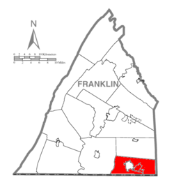
 Map of Franklin County, Pennsylvania highlighting Washington Township |
|
 Map of Franklin County, Pennsylvania |
|
| Country | United States |
| State | Pennsylvania |
| County | Franklin |
| Settled | 1735 |
| Incorporated | 1779 |
| Area | |
| • Total | 39.06 sq mi (101.16 km2) |
| • Land | 39.05 sq mi (101.14 km2) |
| • Water | 0.008 sq mi (0.02 km2) |
| Population (2010) | |
| • Total | 14,009 |
| • Density | 359/sq mi (138.5/km2) |
| Time zone | Eastern (EST) (UTC-5) |
| • Summer (DST) | EDT (UTC-4) |
| Area code(s) | 717 |
| Website | www |
Washington Township is a township in Franklin County, Pennsylvania, United States. The population was 14,009 at the 2010 census, up from 11,559 at the 2000 census.
Handycraft Farmstead, Harbaugh's Reformed Church, Jeremiah Burns Farm, Red Run Lodge, Monterey Historic District, Springdale Mills, Waynesboro Armory, and the Welty's Mill Bridge are listed on the National Register of Historic Places.
The township occupies the southeast corner of Franklin County, bounded to the east by Adams County and to the south by Washington and Frederick counties in the state of Maryland. The township surrounds the borough of Waynesboro, a separate municipality.
The western two-thirds of the township are in the Great Appalachian Valley, while the eastern third is on the ridges and valleys of South Mountain. The Appalachian Trail traverses South Mountain through the township.
...
Wikipedia
