Wards of Glasgow
| Wards of Glasgow | |
|---|---|
| Electoral Districts (Wards) | |

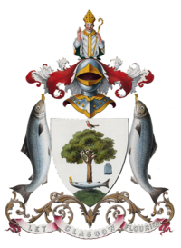
The coat of arms for the City of Glasgow
|
|
| Country |
Scotland |
| City | Glasgow |
| Council | Glasgow City Council |
| Area | |
| • Total | 176 km2 (68 sq mi) |
| Population | |
| • Total | 606,340 |
| • Density | 3,400/km2 (8,900/sq mi) |
The City of Glasgow is divided into a number of wards. These electoral districts, as they are also known, are used to elect councillors to Glasgow City Council. The council, composed of the elected members from each ward, provides local government services to the City of Glasgow.
There are 23 wards situated within the perimeters of Glasgow City Council. Each one elects 3 or 4 councillors every five years in the Scottish local council elections. The most recent elections were held in 2017.
Glasgow City Council is one of the 32 council areas for Scotland (each council containing a number of wards). The boundaries for all Scottish council areas and their sub divisional wards are regulated and regularly reviewed by the Local Government Boundary Commission for Scotland.
The following is a map of the current party representation for each ward, shown within the area served by Glasgow City Council.
A stripe of colour within a ward boundary is equal to one council seat for the corresponding political party.
Yellow = SNP, Red = Scottish Labour, Blue = Scottish Conservatives, Green = Scottish Greens
The following is a list of each Glasgow ward and its population data.
...
Wikipedia
