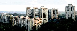
Wadala
|
Wadala वडाळा |
|
|---|---|
| Locality | |

Dosti Acres, Wadala East
|
|
| Coordinates: 19°01′18″N 72°51′53″E / 19.021632°N 72.86459°ECoordinates: 19°01′18″N 72°51′53″E / 19.021632°N 72.86459°E | |
| Country |
|
| State | Maharashtra |
| District | Mumbai City |
| Metro | Mumbai |
| Zone | 4 |
| Ward | F North |
| Languages | |
| • Official | Marathi |
| Time zone | IST (UTC+5:30) |
| PIN | 400 031 400 037 |
| Vehicle registration | MH-03 |
| Lok Sabha constituency | Mumbai South Central |
| Vidhan Sabha constituency | Naigaon |
Wadala (also spelled Vadala, formerly spelt Wuddala) is a locality in Mumbai. Wadala Road is a station on the Harbour Line of Mumbai's railway network.
Wadala has several schools and some renowned institutions like Veermata Jijabai Technological Institute (VJTI), The University Institute of Chemical Technology (formerly The University Department of Chemical Technology (UDCT)), Vidyalankar Institute of Technology(VIT), South India Welfare Society (S.I.W.S),Auxilium Convent High School and Khalsa College, located near one another. SNDT Women's University, Dr. Ambedkar Commerce & Law College also has a campus in Wadala West. The local college of Wadala is SIWS near the Wadala station. The largest bus depot in Mumbai, BEST's Wadala depot, is located here.
It also houses one of India's most renowned eye hospitals, Aditya Jyot Eye Hospital along with the BPT Hospital and the Ackworth Leprosy Hospital. The Ackworth Leprosy Hospital was established during British rule, and part of its complex is now given to an AIDS awareness organisation as well. The world's first methane generation plant was set up in the Ackworth hospital complex.
Wadala village lay on one of the Seven Islands of Bombay that were joined together to form the modern day Mumbai. The island was previously called by different names: Parel, Matunga, Dharavi or Sion.
The Dadar-Matunga-Wadala-Sion scheme of 1899-1900 was the first planned suburban scheme in Bombay. The Bombay City Improvement Trust which was set after a bill was passed in the British parliament, formulated this plan in order to relieve congestion in the centre of the town, following the plague epidemics of the 1890s. According to the survey plan, 85,000 people were to be accommodated in the developments in Wadala.
...
Wikipedia

