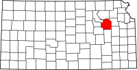
Wabaunsee County, Kansas
| Wabaunsee County, Kansas | |
|---|---|
| County | |

Sacred Heart Catholic Church in Newbury
|
|
 Location in the U.S. state of Kansas |
|
 Kansas's location in the U.S. |
|
| Founded | 1859 |
| Named for | Chief Waubonsie |
| Seat | Alma |
| Largest city | Alma |
| Area | |
| • Total | 800 sq mi (2,072 km2) |
| • Land | 794 sq mi (2,056 km2) |
| • Water | 5.3 sq mi (14 km2), 7% |
| Population | |
| • (2010) | 7,053 |
| • Density | 8.7/sq mi (3/km²) |
| Congressional district | 1st |
| Time zone | Central: UTC-6/-5 |
| Website | County Website |
Coordinates: 38°58′N 96°11′W / 38.967°N 96.183°W
Wabaunsee County (standard abbreviation: WB) is a county located in the U.S. state of Kansas. As of the 2010 census, the county population was 7,053. Its county seat is Alma. The county was created by the territorial legislature of Kansas Territory on March 25, 1859, and was named for a chief of the Potawatomi Indians.
For millennia, the land now known as Kansas was inhabited by Native Americans. In 1803, most of modern Kansas was secured by the United States as part of the Louisiana Purchase. The first white settlers in the area were said to have been a band of outlaws known as the McDaniel Gang.
In 1854, the Kansas Territory was organized and Wabaunsee County was created by the territorial legislature on March 25, 1859. The name used since 1859 is derived from the Potawatomi "Wah-bon-seh", meaning "dawn of day" literally, and it was the name of the chief of the Potawatomi Indians. Originally, the county was named Richardson, after William P. Richardson, a congressman from Illinois, who introduced the first Kansas and Nebraska Bill in the House of Representatives, which made certain Indian lands territories in 1854.
...
Wikipedia
