Wülfrath
| Wülfrath | ||
|---|---|---|
 |
||
|
||
| Coordinates: 51°17′0″N 7°02′0″E / 51.28333°N 7.03333°ECoordinates: 51°17′0″N 7°02′0″E / 51.28333°N 7.03333°E | ||
| Country | Germany | |
| State | North Rhine-Westphalia | |
| Admin. region | Düsseldorf | |
| District | Mettmann | |
| Government | ||
| • Mayor | Dr. Claudia-Almut Panke | |
| Area | ||
| • Total | 32.23 km2 (12.44 sq mi) | |
| Elevation | 262 m (860 ft) | |
| Population (2015-12-31) | ||
| • Total | 21,223 | |
| • Density | 660/km2 (1,700/sq mi) | |
| Time zone | CET/CEST (UTC+1/+2) | |
| Postal codes | 42489 | |
| Dialling codes | 02058 | |
| Vehicle registration | ME | |
| Website | www.wuelfrath.de | |
Wülfrath is a town in the district of Mettmann (district), in North Rhine-Westphalia, Germany.
The town is situated on the mountain spurs of the Bergische Land, between the Rhine, Ruhr and Wupper rivers. It is located in the central part of the Berg region, approx. 12 km northeast of Düsseldorf.
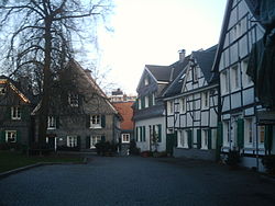
The old town centre lies in the small valley of the Angerbach, a brook which rises nearby and flows through the town. The newer parts of the town are built on the valley slopes.
Wülfrath was one of the first settlements to be made in a clearing in the great Imperial forest of the early Middle Ages. The name means clearing of a man named Wolf and its date of origin is thought to be about 713. Around this has grown up the legend of a settler called Wolf who had been expelled from his clan and who is supposed to have made a clearing in the then luxuriant forest on the site of the present village centre.
In 875 the hundreds (Honnschaften) and present suburbs of Flandersbach (Flatmarasbeki, i.e., Flattmar's brook) and Rützkausen (Hrotsteninghuson, i.e., the houses of Hrotse's people) are named in a description of the places owing tithes to Werden Abbey on the Ruhr. In around 1100 the placename Wülfrath (Wolverothe) itself is at last mentioned in a document written in a monk's hand at the religious house at Kaiserswerth.
The boundaries are given in a deed of grant of the Emperor Henry VI dated 16 October 1165 as the courses of the Rhein, Ruhr and Düssel (Tussella) rivers. The eastern boundary was the old highway of the "Kölnische Straße" (strata colonensis), which ran from the bridge over the Ruhr at Werden via Velbert and Wülfrath along the Düssel towards Cologne. The centre of the mediaeval village was a demesne farm or manor (Mollmershof), which as part of the lordship of Hardenberg was sold to the Counts of Berg. Possession of this manor, to which an extensive group of scattered farms belonged, particularly in the hundreds of Erbach and Püttbach, also gave control of the advowson of the church, that is, the right to appoint the priest.
...
Wikipedia


