Volusia
| Volusia County, Florida | ||
|---|---|---|
| County | ||
| County of Volusia | ||

Volusia County courthouse in DeLand, built in 2001.
|
||
|
||
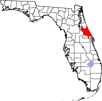
 Location in the U.S. state of Florida |
||
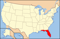
 Florida's location in the U.S. |
||
| Founded | December 29, 1854 | |
| Named for | Community of Volusia | |
| Seat | DeLand | |
| Largest city | Deltona | |
| Area | ||
| • Total | 1,432.44 sq mi (3,710 km2) | |
| • Land | 1,101.03 sq mi (2,852 km2) | |
| • Water | 331.40 sq mi (858 km2), 23.14% | |
| Population (est.) | ||
| • (2015) | 517,887 | |
| • Density | 449.2/sq mi (173/km²) | |
| Congressional district | 6th | |
| Time zone | Eastern: UTC-5/-4 | |
| Website | www |
|
Volusia County (/vəˈluːʃə/, və-LOOSH-ə) is located in the east-central part of the U.S. state of Florida, stretching between the St. Johns River and the Atlantic Ocean. As of the 2010 census, the county was home to 494,593 people, an increase of 11.6% from 2000. Its county seat is DeLand. It was founded on December 29, 1854, and was named for the community of Volusia, located in northwestern Volusia County.
Volusia County is part of the Deltona–Daytona Beach–Ormond Beach, FL metropolitan statistical area, and is also part of the larger Orlando–Deltona–Daytona Beach, FL Combined Statistical Area.
Volusia County was named after the then-largest-community, Volusia, when the Florida legislature divided Orange County on December 29, 1854. At the time, Volusia County had as few as 600 residents.
The origins of the word "Volusia" are unclear, though there are several theories:
The land area of present-day Volusia County was inhabited by the indigenous Timucua, and Mayaca people . Neither group exists today as distinct racial entities, having been decimated by war and disease after contact with European settlers. Evidence of their habitation can still be seen in various areas of Volusia County such as the large shell middens at Tomoka State Park.
...
Wikipedia

