Vlamertinge
|
Ypres Ieper |
|||
|---|---|---|---|
| Municipality | |||
 |
|||
|
|||
| Location in Belgium | |||
|
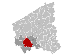
Location of Ypres in West Flanders
|
|||
| Coordinates: 50°51′N 02°53′E / 50.850°N 2.883°ECoordinates: 50°51′N 02°53′E / 50.850°N 2.883°E | |||
| Country | Belgium | ||
| Community | Flemish Community | ||
| Region | Flemish Region | ||
| Province | West Flanders | ||
| Arrondissement | Ypres | ||
| Government | |||
| • Mayor | Jan Durnez (CD&V) | ||
| • Governing party/ies | CD&V & N-VA | ||
| Area | |||
| • Total | 130.61 km2 (50.43 sq mi) | ||
| Population (1 January 2016) | |||
| • Total | 34,959 | ||
| • Density | 270/km2 (690/sq mi) | ||
| Postal codes | 8900, 8902, 8904, 8906, 8908 | ||
| Area codes | 057 | ||
| Website | www.ieper.be | ||
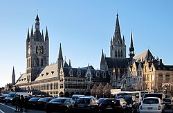
Ypres (/ˈiːprə/; French pronunciation: [ipʁ]; Dutch: Ieper, pronounced [ˈipər]) is a Belgian municipality located in the Flemish province of West Flanders. Though Ieper is the official name, the city's French name, Ypres, is most commonly used in English. The municipality comprises the city of Ypres and the villages of Boezinge, Brielen, Dikkebus, Elverdinge, Hollebeke, Sint-Jan, Vlamertinge, Voormezele, Zillebeke, and Zuidschote. Together, they are home to about 34,900 inhabitants.
During the First World War, Ypres was the centre of between German and Allied forces. During the war it was nicknamed "Wipers", as its name was difficult for English-speaking British Imperial forces troops to pronounce.
Ypres is an ancient town, known to have been raided by the Romans in the first century BC. It is first mentioned by name in 1066 and is probably named after the river Ieperlee on the banks of which it was founded.
During the Middle Ages, Ypres was a prosperous Flemish city with a population of 40,000 in 1200 AD, renowned for its linen trade with England, which was mentioned in the Canterbury Tales.
...
Wikipedia


